Anastácio night lights from space
Night Light of Anastácio (Mato Grosso do Sul) from space (Brazil) Src. Average luminocity for 10x10km area is 35.6648% and for 50x50km: 1.9519%.
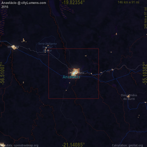
Analysis of Anastácio night lights 2016
Square area 10x10 km:
 2.65%
2.65%90-99
3.98%80-89
7.58%70-79
8.52%60-69
9.28%50-59
3.03%40-49
4.92%30-39
2.46%20-29
3.22%10-19
25.57%0-9
28.79%Square area 50x50 km:
0.11%90-99
0.17%80-89
0.32%70-79
0.36%60-69
0.43%50-59
0.27%40-49
0.34%30-39
0.11%20-29
0.16%10-19
1.8%0-9
95.93%Clear (daylight) street map image can be seen on geolist.org.
Map coordinates:
19° 49' 24.7" South, 56° 30' 36.3" West
20° 29' 1" South, 55° 48' 25" West
21° 8' 27.1" South, 55° 6' 13.8" West
Some cities around Anastácio sort by population:
• Campo Grande
121 km =75.2 mi,  87°
87°
• Aquidauana
2.5 km =1.6 mi,  55°
55°
• Jardim
116 km =72.1 mi,  197°
197°
• Sidrolândia
101.1 km =62.8 mi,  119°
119°
• Bonito
99.7 km =62 mi,  224°
224°
• Miranda
65.4 km =40.6 mi,  294°
294°
• Guia Lopes da Laguna
112.9 km =70.2 mi, 196°
• Terenos
98.7 km =61.3 mi, 87°
3472284 (p: 18,817)
Sources (retrieved 2019-11-25):
» Earth at Night: Flat Maps 2012, 2016