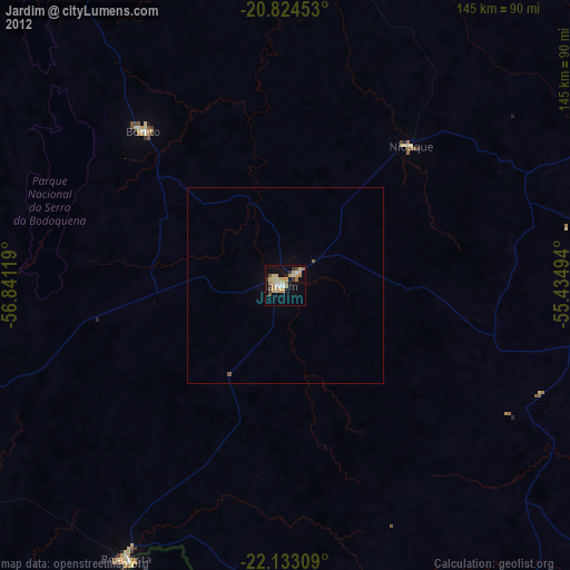
Jardim night lights from space
Night Light of Jardim (Mato Grosso do Sul) from space (Brazil) Src. Average luminocity for 10x10km area is 24.6269% and for 50x50km: 1.1397%.
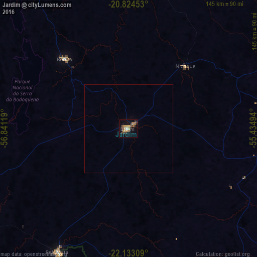
Analysis of Jardim night lights 2016
Square area 10x10 km:
 0.57%
0.57%90-99
2.46%80-89
4.92%70-79
4.17%60-69
6.44%50-59
1.89%40-49
6.44%30-39
2.65%20-29
2.27%10-19
17.99%0-9
50.19%Square area 50x50 km:
0.02%90-99
0.1%80-89
0.21%70-79
0.18%60-69
0.27%50-59
0.08%40-49
0.27%30-39
0.11%20-29
0.1%10-19
0.76%0-9
97.9%Clear (daylight) street map image can be seen on geolist.org.
Map coordinates:
20° 49' 28.3" South, 56° 50' 28.3" West
21° 28' 49" South, 56° 8' 17" West
22° 7' 59.1" South, 55° 26' 5.8" West
Some cities around Jardim sort by population:
• Ponta Porã
124.9 km =77.6 mi,  160°
160°
• Aquidauana
118 km =73.3 mi,  17°
17°
• Maracaju
101.4 km =63 mi,  98°
98°
• Anastácio
116 km =72.1 mi, 17°
• Bela Vista
80.3 km =49.9 mi,  209°
209°
• Bonito
53.5 km =33.2 mi,  318°
318°
• Guia Lopes da Laguna
3.5 km =2.2 mi,  44°
44°
• Bella Vista, PY
82.5 km =51.3 mi, 208°
3460087 (p: 23,780)
Sources (retrieved 2019-11-25):
» Earth at Night: Flat Maps 2012, 2016