Sidrolândia night lights from space
Night Light of Sidrolândia (Mato Grosso do Sul) from space (Brazil) Src. Average luminocity for 10x10km area is 17.3651% and for 50x50km: 0.8391%.
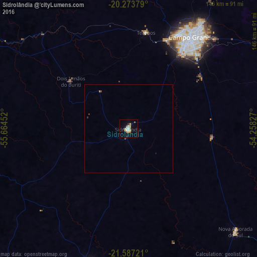
Analysis of Sidrolândia night lights 2016
Square area 10x10 km:
 2.58%
2.58%90-99
3.77%80-89
2.78%70-79
1.39%60-69
2.18%50-59
1.59%40-49
0.79%30-39
2.18%20-29
0.6%10-19
4.17%0-9
77.98%Square area 50x50 km:
0.1%90-99
0.15%80-89
0.11%70-79
0.09%60-69
0.09%50-59
0.08%40-49
0.09%30-39
0.15%20-29
0.04%10-19
0.2%0-9
98.9%Clear (daylight) street map image can be seen on geolist.org.
Map coordinates:
20° 16' 25.6" South, 55° 39' 52.3" West
20° 55' 55" South, 54° 57' 41" West
21° 35' 14" South, 54° 15' 29.8" West
Some cities around Sidrolândia sort by population:
• Campo Grande
63.5 km =39.5 mi,  31°
31°
• Aquidauana
100 km =62.1 mi,  300°
300°
• Campo Verde
109.3 km =67.9 mi,  58°
58°
• Maracaju
78.9 km =49 mi,  195°
195°
• Rio Brilhante
105.8 km =65.7 mi,  156°
156°
• Anastácio
101.1 km =62.8 mi, 299°
• Guia Lopes da Laguna
133 km =82.6 mi,  243°
243°
• Terenos
55.5 km =34.5 mi,  10°
10°
3447597 (p: 16,878)
Sources (retrieved 2019-11-25):
» Earth at Night: Flat Maps 2012, 2016