Bonito night lights from space
Night Light of Bonito (Mato Grosso do Sul) from space (Brazil) Src. Average luminocity for 10x10km area is 15.381% and for 50x50km: 0.6785%.
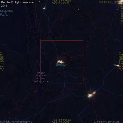
Analysis of Bonito night lights 2016
Square area 10x10 km:
 0.79%
0.79%90-99
0.79%80-89
5.75%70-79
1.59%60-69
1.39%50-59
1.79%40-49
2.98%30-39
2.98%20-29
0.99%10-19
2.78%0-9
78.17%Square area 50x50 km:
0.03%90-99
0.03%80-89
0.23%70-79
0.06%60-69
0.06%50-59
0.07%40-49
0.12%30-39
0.12%20-29
0.07%10-19
0.15%0-9
99.05%Clear (daylight) street map image can be seen on geolist.org.
Map coordinates:
20° 27' 49.6" South, 57° 11' 6.3" West
21° 7' 16" South, 56° 28' 55" West
21° 46' 31.9" South, 55° 46' 43.8" West
Some cities around Bonito sort by population:
• Aquidauana
102.2 km =63.5 mi,  44°
44°
• Jardim
53.5 km =33.2 mi,  138°
138°
• Anastácio
99.7 km =62 mi, 44°
• Bela Vista
109.9 km =68.3 mi,  182°
182°
• Miranda
98.5 km =61.2 mi,  6°
6°
• Guia Lopes da Laguna
53.4 km =33.2 mi,  134°
134°
• Bella Vista, PY
112.6 km =70 mi, 181°
• Fuerte Olimpo, PY
144.7 km =89.9 mi,  273°
273°
3469294 (p: 14,504)
Sources (retrieved 2019-11-25):
» Earth at Night: Flat Maps 2012, 2016