Alvinópolis night lights from space
Night Light of Alvinópolis (Minas Gerais) from space (Brazil) Src. Average luminocity for 10x10km area is 3.746% and for 50x50km: 1.1605%.
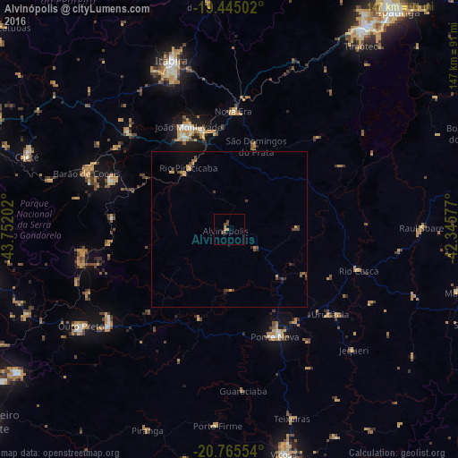
Analysis of Alvinópolis night lights 2016
Square area 10x10 km:
 0%
0%90-99
0%80-89
0%70-79
1.39%60-69
0.99%50-59
0%40-49
3.57%30-39
0.4%20-29
0%10-19
0%0-9
93.65%Square area 50x50 km:
0%90-99
0%80-89
0.04%70-79
0.44%60-69
0.15%50-59
0.18%40-49
0.44%30-39
0.35%20-29
0.17%10-19
0.19%0-9
98.05%Clear (daylight) street map image can be seen on geolist.org.
Map coordinates:
19° 26' 42.1" South, 43° 45' 7.3" West
20° 6' 24" South, 43° 2' 56" West
20° 45' 55.9" South, 42° 20' 44.8" West
Some cities around Alvinópolis sort by population:
• João Monlevade
35.5 km =22.1 mi,  338°
338°
• Ponte Nova
37.4 km =23.2 mi,  156°
156°
• Mariana
48.7 km =30.3 mi,  231°
231°
• Barão de Cocais
49.2 km =30.6 mi,  291°
291°
• Nova Era
39.7 km =24.7 mi,  1°
1°
• Rio Casca
43.6 km =27.1 mi,  107°
107°
• Rio Piracicaba
23.7 km =14.7 mi,  326°
326°
• São Domingos do Prata
28.2 km =17.5 mi,  17°
17°
3472406 (p: 12,068)
Sources (retrieved 2019-11-25):
» Earth at Night: Flat Maps 2012, 2016