Alfenas night lights from space
Night Light of Alfenas (Minas Gerais) from space (Brazil) Src. Average luminocity for 10x10km area is 32.5019% and for 50x50km: 2.9427%.
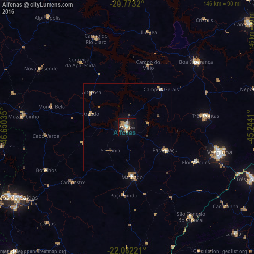
Analysis of Alfenas night lights 2016
Square area 10x10 km:
 4.73%
4.73%90-99
5.87%80-89
3.03%70-79
7.58%60-69
6.06%50-59
1.52%40-49
0.76%30-39
4.73%20-29
2.84%10-19
36.55%0-9
26.33%Square area 50x50 km:
0.27%90-99
0.49%80-89
0.26%70-79
0.63%60-69
0.56%50-59
0.23%40-49
0.15%30-39
0.45%20-29
0.22%10-19
1.93%0-9
94.81%Clear (daylight) street map image can be seen on geolist.org.
Map coordinates:
20° 46' 23.5" South, 46° 39' 1.3" West
21° 25' 45" South, 45° 56' 50" West
22° 4' 56" South, 45° 14' 38.8" West
Some cities around Alfenas sort by population:
• Três Pontas
45.5 km =28.3 mi,  81°
81°
• Machado
27.5 km =17.1 mi,  174°
174°
• Campos Gerais
29.1 km =18.1 mi,  42°
42°
• Elói Mendes
44.3 km =27.5 mi,  116°
116°
• Paraguaçu
25.4 km =15.8 mi, 121°
• Campestre
44 km =27.3 mi,  224°
224°
• Areado
22 km =13.7 mi,  290°
290°
• Alterosa
28.5 km =17.7 mi,  314°
314°
3472603 (p: 71,406)
Sources (retrieved 2019-11-25):
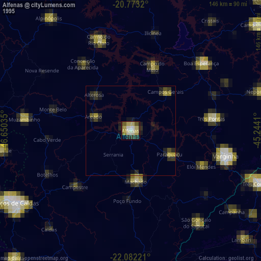
» NASA, Earths city lights 1995
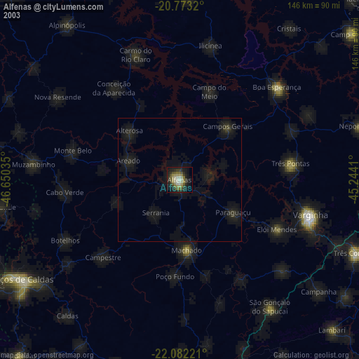
» NASA city lights 2003
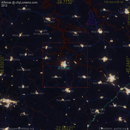
» Earth at Night: Flat Maps 2012, 2016