Água Branca night lights from space
Night Light of Água Branca (Piauí) from space (Brazil) Src. Average luminocity for 10x10km area is 9.157% and for 50x50km: 1.6369%.
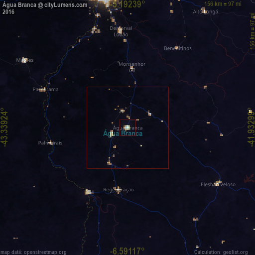
Analysis of Água Branca night lights 2016
Square area 10x10 km:
 0.83%
0.83%90-99
1.24%80-89
1.24%70-79
0.83%60-69
1.86%50-59
0.83%40-49
2.27%30-39
0.83%20-29
0.83%10-19
0%0-9
89.26%Square area 50x50 km:
0.03%90-99
0.14%80-89
0.23%70-79
0.26%60-69
0.31%50-59
0.38%40-49
0.37%30-39
0.19%20-29
0.35%10-19
0.21%0-9
97.54%Clear (daylight) street map image can be seen on geolist.org.
Map coordinates:
5° 11' 32.6" South, 43° 20' 21.3" West
5° 53' 32" South, 42° 38' 10" West
6° 35' 28.2" South, 41° 55' 58.8" West
Some cities around Água Branca sort by population:
• Estreito
69 km =42.9 mi,  280°
280°
• Demerval Lobão
59.5 km =37 mi,  355°
355°
• Regeneração
38.1 km =23.7 mi,  188°
188°
• Parnarama
55.7 km =34.6 mi,  294°
294°
• Elesbão Veloso
64.7 km =40.2 mi,  122°
122°
• Amarante
45.4 km =28.2 mi,  210°
210°
• São Pedro do Piauí
10 km =6.2 mi,  245°
245°
• Beneditinos
57.5 km =35.7 mi,  31°
31°
3408221 (p: 13,912)
Sources (retrieved 2019-11-25):
» Earth at Night: Flat Maps 2012, 2016