Yacuiba night lights from space
Night Light of Yacuiba (Tarija) from space (Bolivia) Src. Average luminocity for 10x10km area is 30.7599% and for 50x50km: 3.3735%.
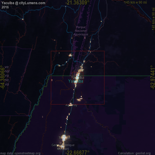
Analysis of Yacuiba night lights 2016
Square area 10x10 km:
 5.75%
5.75%90-99
5.95%80-89
2.78%70-79
4.17%60-69
4.17%50-59
2.58%40-49
1.59%30-39
1.98%20-29
1.59%10-19
49.6%0-9
19.84%Square area 50x50 km:
0.36%90-99
0.34%80-89
0.48%70-79
0.46%60-69
0.48%50-59
0.38%40-49
0.44%30-39
0.56%20-29
0.28%10-19
3.07%0-9
93.14%Clear (daylight) street map image can be seen on geolist.org.
Map coordinates:
21° 21' 47.1" South, 64° 22' 50.4" West
22° 0' 59.1" South, 63° 40' 39.1" West
22° 40' 0.4" South, 62° 58' 27.9" West
Some cities around Yacuiba sort by population:
• Tarija
121.1 km =75.2 mi,  296°
296°
• San Ramón de la Nueva Orán, AR
141.2 km =87.7 mi,  208°
208°
• Tartagal, AR
57 km =35.4 mi,  192°
192°
• Bermejo
104.6 km =65 mi,  220°
220°
• Embarcación, AR
139.6 km =86.7 mi,  198°
198°
• General Enrique Mosconi, AR
65.9 km =40.9 mi, 192°
• Villamontes
86.6 km =53.8 mi,  14°
14°
• La Quiaca, AR
197.6 km =122.8 mi,  267°
267°
3901178 (p: 82,803)
Sources (retrieved 2019-11-25):
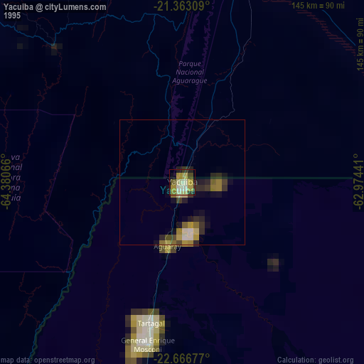
» NASA, Earths city lights 1995
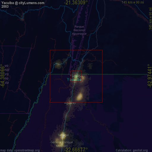
» NASA city lights 2003
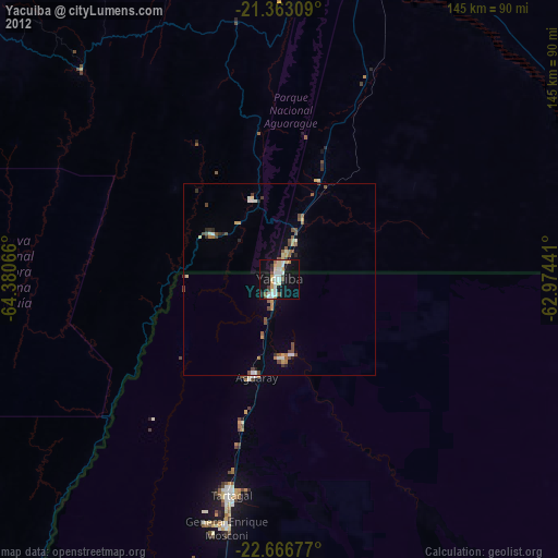
» Earth at Night: Flat Maps 2012, 2016