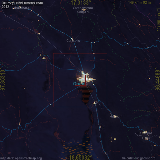
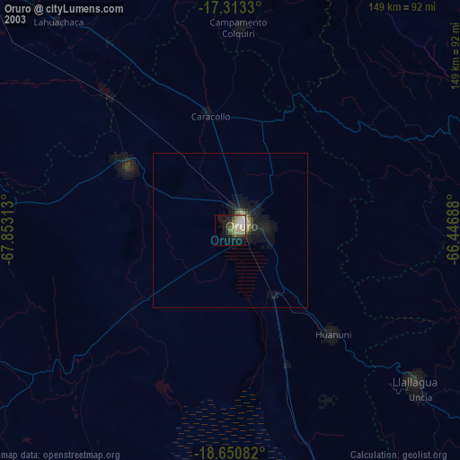
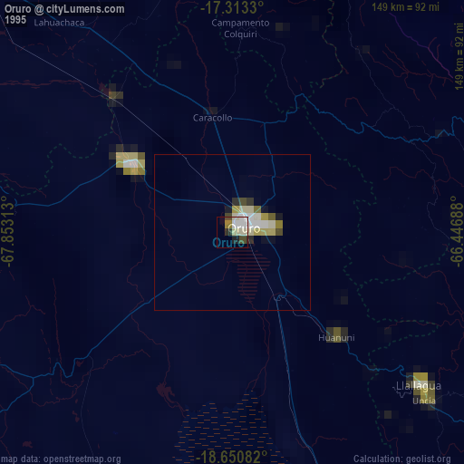
Oruro night lights from space
Night Light of Oruro from space (Bolivia) Src. Average luminocity for 10x10km area is 43.1385% and for 50x50km: 5.346%.
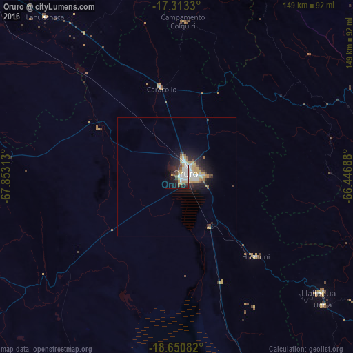
Analysis of Oruro night lights 2016
Square area 10x10 km:
 12.55%
90-99
9.96%80-89
3.03%70-79
5.63%60-69
3.03%50-59
3.46%40-49
4.98%30-39
2.6%20-29
11.9%10-19
21.65%0-9
21.21%Square area 50x50 km:
1.08%90-99
0.95%80-89
0.47%70-79
1.11%60-69
0.39%50-59
0.37%40-49
0.51%30-39
0.43%20-29
1.75%10-19
3.68%0-9
89.25%Clear (daylight) street map image can be seen on geolist.org.
Map coordinates:
17° 18' 47.9" South, 67° 51' 11.3" West
17° 58' 60" South, 67° 9' 0" West
18° 39' 3" South, 66° 26' 48.8" West
Some cities around Oruro sort by population:
• Cochabamba
124.2 km =77.2 mi,  57°
57°
• Quillacollo
113.3 km =70.4 mi,  54°
54°
• Tiquipaya
122.3 km =76 mi, 54°
• Llallagua
77.3 km =48 mi,  129°
129°
• Huanuni
47.5 km =29.5 mi,  135°
135°
• Patacamaya
116.6 km =72.5 mi,  315°
315°
• Challapata
109.7 km =68.2 mi,  158°
158°
• Capinota
98.9 km =61.5 mi,  72°
72°
3909234 (p: 208,684)
Sources (retrieved 2019-11-25):
» NASA, Earths city lights 1995
» NASA city lights 2003
» Earth at Night: Flat Maps 2012, 2016