Quillacollo night lights from space
Night Light of Quillacollo (Cochabamba) from space (Bolivia) Src. Average luminocity for 10x10km area is 83.4401% and for 50x50km: 21.1531%.
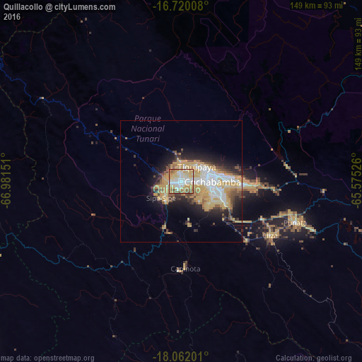
Analysis of Quillacollo night lights 2016
Square area 10x10 km:
 18.39%
90-99
24.79%80-89
17.15%70-79
22.31%60-69
7.64%50-59
7.64%40-49
2.07%30-39
0%20-29
0%10-19
0%0-9
0%Square area 50x50 km:
3.29%90-99
3.73%80-89
3.26%70-79
6.5%60-69
1.95%50-59
1.75%40-49
2.35%30-39
1.94%20-29
4.31%10-19
7.12%0-9
63.81%Clear (daylight) street map image can be seen on geolist.org.
Map coordinates:
16° 43' 12.3" South, 66° 58' 53.4" West
17° 23' 32.2" South, 66° 16' 42.2" West
18° 3' 43.2" South, 65° 34' 30.9" West
Some cities around Quillacollo sort by population:
• Cochabamba
12.9 km =8 mi,  88°
88°
• Oruro
113.3 km =70.4 mi,  234°
234°
• Sacaba
25.5 km =15.8 mi, 91°
• Tiquipaya
9 km =5.6 mi,  47°
47°
• Punata
49.9 km =31 mi,  109°
109°
• Cliza
42.6 km =26.5 mi,  120°
120°
• Tarata
36.4 km =22.6 mi,  131°
131°
• Capinota
35.5 km =22.1 mi,  176°
176°
3906791 (p: 87,309)
Sources (retrieved 2019-11-25):
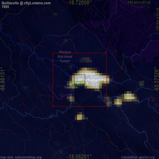
» NASA, Earths city lights 1995
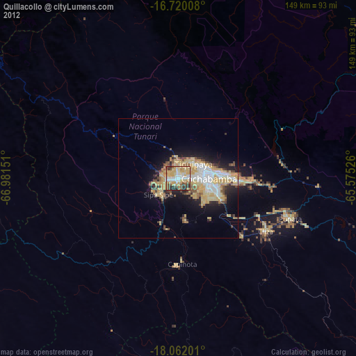
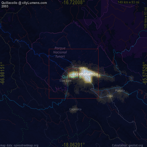
» NASA city lights 2003
» Earth at Night: Flat Maps 2012, 2016