Cochabamba night lights from space
Night Light of Cochabamba from space (Bolivia) Src. Average luminocity for 10x10km area is 92.0062% and for 50x50km: 24.7956%.
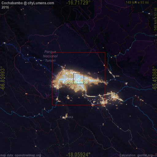
Analysis of Cochabamba night lights 2016
Square area 10x10 km:
 38.02%
90-99
32.02%80-89
16.12%70-79
8.06%60-69
1.45%50-59
1.65%40-49
2.07%30-39
0.62%20-29
0%10-19
0%0-9
0%Square area 50x50 km:
3.35%90-99
3.9%80-89
3.61%70-79
7.72%60-69
2.61%50-59
2.12%40-49
3.22%30-39
2.4%20-29
5.29%10-19
10.53%0-9
55.26%Clear (daylight) street map image can be seen on geolist.org.
Map coordinates:
16° 43' 2.2" South, 66° 51' 35.7" West
17° 23' 22.2" South, 66° 9' 24.5" West
18° 3' 33.3" South, 65° 27' 13.2" West
Some cities around Cochabamba sort by population:
• Sacaba
12.6 km =7.8 mi,  94°
94°
• Quillacollo
12.9 km =8 mi,  268°
268°
• Tiquipaya
8.5 km =5.3 mi,  312°
312°
• Mizque
106 km =65.9 mi,  125°
125°
• Punata
38.2 km =23.7 mi,  116°
116°
• Cliza
32.4 km =20.1 mi, 132°
• Tarata
28.3 km =17.6 mi,  149°
149°
• Capinota
37.4 km =23.2 mi,  197°
197°
3919968 (p: 900,414)
Sources (retrieved 2019-11-25):
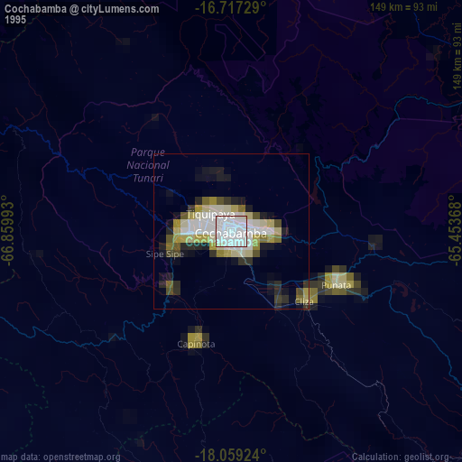
» NASA, Earths city lights 1995
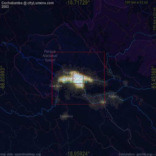
» NASA city lights 2003
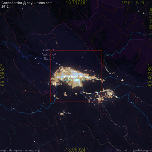
» Earth at Night: Flat Maps 2012, 2016