Montero night lights from space
Night Light of Montero (Santa Cruz) from space (Bolivia) Src. Average luminocity for 10x10km area is 46.9566% and for 50x50km: 5.5868%.
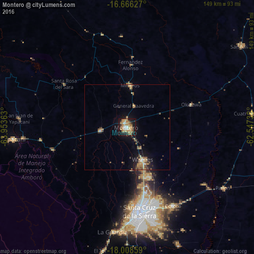

Analysis of Montero night lights 2016
Square area 10x10 km:
 3.93%
3.93%90-99
4.96%80-89
9.3%70-79
9.3%60-69
16.74%50-59
2.89%40-49
3.51%30-39
7.44%20-29
5.79%10-19
34.3%0-9
1.86%Square area 50x50 km:
0.26%90-99
0.34%80-89
0.97%70-79
0.85%60-69
1.36%50-59
0.92%40-49
0.61%30-39
0.93%20-29
0.76%10-19
4.98%0-9
88.02%Clear (daylight) street map image can be seen on geolist.org.
Map coordinates:
16° 39' 58.6" South, 63° 57' 13.1" West
17° 20' 19.2" South, 63° 15' 1.8" West
18° 0' 30.9" South, 62° 32' 50.6" West
Some cities around Montero sort by population:
• Santa Cruz de la Sierra
50.3 km =31.3 mi,  171°
171°
• Warnes
21.6 km =13.4 mi,  156°
156°
• Cotoca
57.2 km =35.5 mi, 158°
• Villa Yapacaní
62.2 km =38.6 mi,  263°
263°
• Mineros
24.5 km =15.2 mi,  4°
4°
• Portachuelo
15.2 km =9.4 mi, 264°
• La Bélgica
23.8 km =14.8 mi, 171°
• Santa Rosa del Sara
44.6 km =27.7 mi,  304°
304°
3910027 (p: 88,616)
Sources (retrieved 2019-11-25):
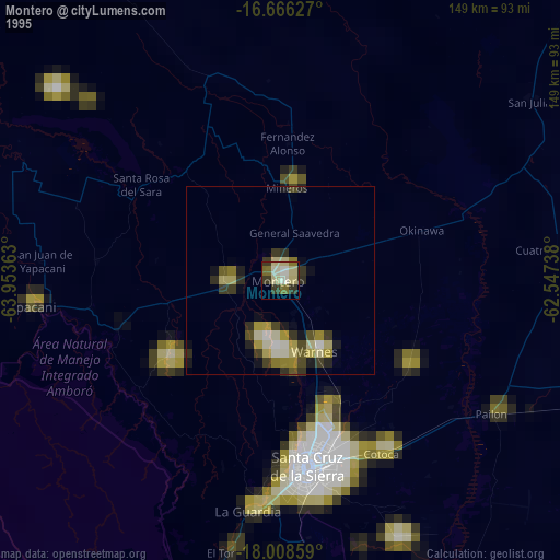
» NASA, Earths city lights 1995
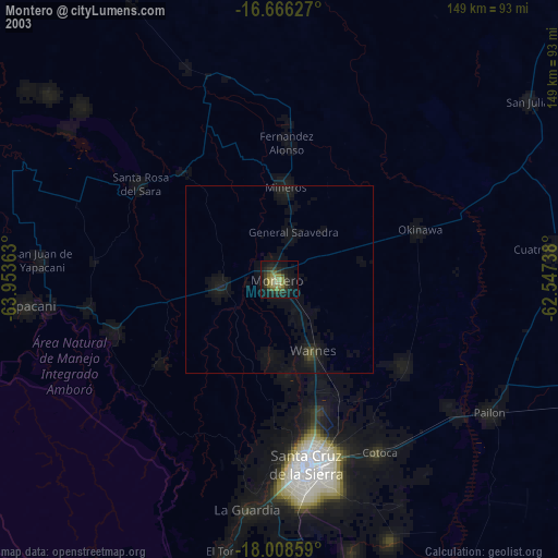
» NASA city lights 2003
» Earth at Night: Flat Maps 2012, 2016