Santa Cruz de la Sierra night lights from space
Night Light of Santa Cruz de la Sierra (Santa Cruz) from space (Bolivia) Src. Average luminocity for 10x10km area is 97.855% and for 50x50km: 28.658%.
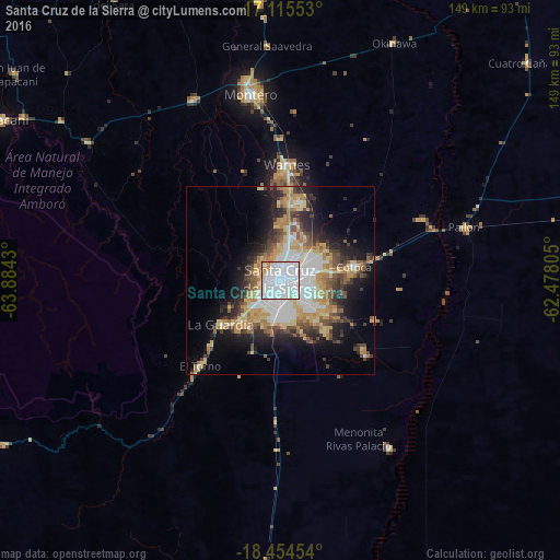
Analysis of Santa Cruz de la Sierra night lights 2016
Square area 10x10 km:
 70.56%
90-99
22.29%80-89
1.73%70-79
4.76%60-69
0.65%50-59
0%40-49
0%30-39
0%20-29
0%10-19
0%0-9
0%Square area 50x50 km:
6.96%90-99
3.91%80-89
5%70-79
4.16%60-69
3.89%50-59
2.8%40-49
3.7%30-39
3.5%20-29
5.7%10-19
9.7%0-9
50.69%Clear (daylight) street map image can be seen on geolist.org.
Map coordinates:
17° 6' 55.9" South, 63° 53' 3.5" West
17° 47' 10.6" South, 63° 10' 52.2" West
18° 27' 16.3" South, 62° 28' 41" West
Some cities around Santa Cruz de la Sierra sort by population:
• Montero
50.3 km =31.3 mi,  351°
351°
• Warnes
30.1 km =18.7 mi,  2°
2°
• Cotoca
14.3 km =8.9 mi,  103°
103°
• Santiago del Torno
30.7 km =19.1 mi,  223°
223°
• Portachuelo
53.3 km =33.1 mi,  335°
335°
• Pailón
48.1 km =29.9 mi,  71°
71°
• San Julian
33.3 km =20.7 mi,  89°
89°
• La Bélgica
26.5 km =16.5 mi, 351°
3904906 (p: 1,364,389)
Sources (retrieved 2019-11-25):
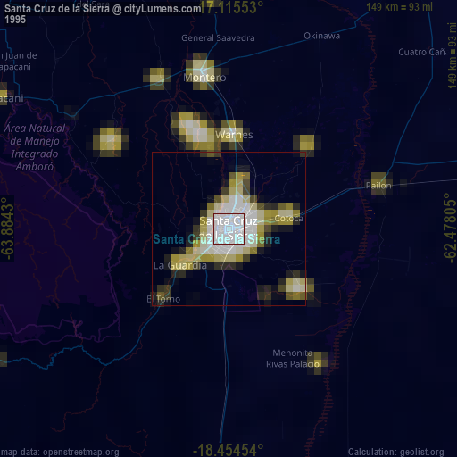
» NASA, Earths city lights 1995
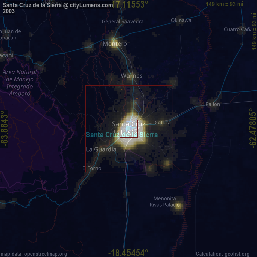
» NASA city lights 2003
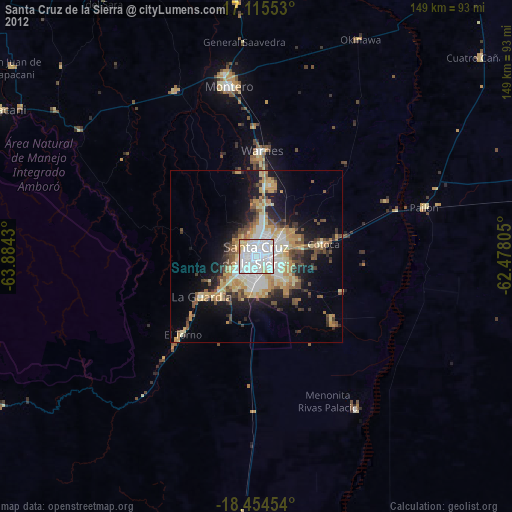
» Earth at Night: Flat Maps 2012, 2016