Mineros night lights from space
Night Light of Mineros (Santa Cruz) from space (Bolivia) Src. Average luminocity for 10x10km area is 12.5433% and for 50x50km: 2.3626%.
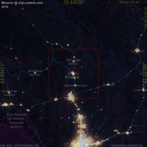
Analysis of Mineros night lights 2016
Square area 10x10 km:
 0%
0%90-99
0.65%80-89
3.68%70-79
1.3%60-69
5.63%50-59
0.87%40-49
1.52%30-39
0.22%20-29
1.95%10-19
0.65%0-9
83.55%Square area 50x50 km:
0.12%90-99
0.19%80-89
0.35%70-79
0.42%60-69
0.76%50-59
0.22%40-49
0.23%30-39
0.37%20-29
0.21%10-19
1.51%0-9
95.63%Clear (daylight) street map image can be seen on geolist.org.
Map coordinates:
16° 26' 44.1" South, 63° 56' 2.9" West
17° 7' 7.5" South, 63° 13' 51.6" West
17° 47' 22.2" South, 62° 31' 40.4" West
Some cities around Mineros sort by population:
• Santa Cruz de la Sierra
74.4 km =46.2 mi,  175°
175°
• Montero
24.5 km =15.2 mi, 184°
• Warnes
44.7 km =27.8 mi,  171°
171°
• Villa Yapacaní
71.2 km =44.2 mi,  243°
243°
• Portachuelo
31.1 km =19.3 mi,  213°
213°
• Pailón
78.1 km =48.5 mi,  139°
139°
• La Bélgica
48 km =29.8 mi, 178°
• Santa Rosa del Sara
38.7 km =24 mi,  271°
271°
3910343 (p: 14,385)
Sources (retrieved 2019-11-25):
» Earth at Night: Flat Maps 2012, 2016