Cotoca night lights from space
Night Light of Cotoca (Santa Cruz) from space (Bolivia) Src. Average luminocity for 10x10km area is 56.4654% and for 50x50km: 26.7984%.
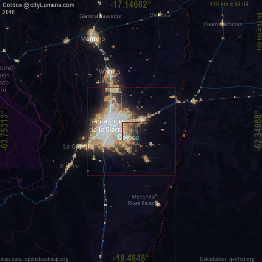
Analysis of Cotoca night lights 2016
Square area 10x10 km:
 4.11%
4.11%90-99
8.44%80-89
8.87%70-79
13.2%60-69
11.26%50-59
13.42%40-49
12.99%30-39
8.44%20-29
10.82%10-19
8.44%0-9
0%Square area 50x50 km:
6.94%90-99
3.88%80-89
4.56%70-79
3.84%60-69
3.47%50-59
2.67%40-49
3.39%30-39
3.33%20-29
4.79%10-19
7.76%0-9
55.38%Clear (daylight) street map image can be seen on geolist.org.
Map coordinates:
17° 8' 45.7" South, 63° 45' 11.3" West
17° 49' 0" South, 63° 3' 0" West
18° 29' 5.3" South, 62° 20' 48.8" West
Some cities around Cotoca sort by population:
• Santa Cruz de la Sierra
14.3 km =8.9 mi,  283°
283°
• Montero
57.2 km =35.5 mi,  338°
338°
• Warnes
35.7 km =22.2 mi, 339°
• Santiago del Torno
39.8 km =24.7 mi,  241°
241°
• Portachuelo
63.2 km =39.3 mi,  324°
324°
• Pailón
36.8 km =22.9 mi,  59°
59°
• San Julian
19.8 km =12.3 mi,  79°
79°
• La Bélgica
34.5 km =21.4 mi,  329°
329°
3918937 (p: 18,347)
Sources (retrieved 2019-11-25):
» Earth at Night: Flat Maps 2012, 2016