Pailón night lights from space
Night Light of Pailón (Santa Cruz) from space (Bolivia) Src. Average luminocity for 10x10km area is 9.2851% and for 50x50km: 1.8637%.
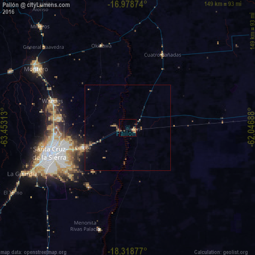
Analysis of Pailón night lights 2016
Square area 10x10 km:
 0%
0%90-99
0%80-89
2.27%70-79
0.83%60-69
3.51%50-59
0.83%40-49
3.1%30-39
1.86%20-29
0%10-19
0%0-9
87.6%Square area 50x50 km:
0%90-99
0.01%80-89
0.25%70-79
0.22%60-69
0.35%50-59
0.59%40-49
0.28%30-39
0.6%20-29
0.26%10-19
1.08%0-9
96.36%Clear (daylight) street map image can be seen on geolist.org.
Map coordinates:
16° 58' 43.5" South, 63° 27' 11.3" West
17° 39' 0" South, 62° 45' 0" West
18° 19' 7.6" South, 62° 2' 48.8" West
Some cities around Pailón sort by population:
• Santa Cruz de la Sierra
48.1 km =29.9 mi,  251°
251°
• Montero
63.4 km =39.4 mi,  303°
303°
• Warnes
46.7 km =29 mi,  288°
288°
• Cotoca
36.8 km =22.9 mi,  239°
239°
• Santiago del Torno
76.6 km =47.6 mi, 240°
• Portachuelo
75.8 km =47.1 mi, 295°
• San Julian
19.3 km =12 mi,  219°
219°
• La Bélgica
50.7 km =31.5 mi,  282°
282°
3909010 (p: 9,304)
Sources (retrieved 2019-11-25):
» Earth at Night: Flat Maps 2012, 2016