Ascención de Guarayos night lights from space
Night Light of Ascención de Guarayos (Santa Cruz) from space (Bolivia) Src. Average luminocity for 10x10km area is 8.4675% and for 50x50km: 0.3306%.
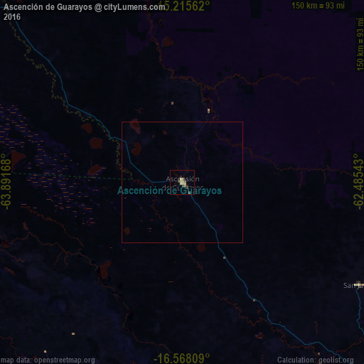
Analysis of Ascención de Guarayos night lights 2016
Square area 10x10 km:
 0%
0%90-99
0%80-89
1.52%70-79
2.6%60-69
1.95%50-59
1.73%40-49
1.73%30-39
1.73%20-29
1.73%10-19
0%0-9
87.01%Square area 50x50 km:
0%90-99
0%80-89
0.06%70-79
0.1%60-69
0.07%50-59
0.07%40-49
0.07%30-39
0.07%20-29
0.07%10-19
0%0-9
99.51%Clear (daylight) street map image can be seen on geolist.org.
Map coordinates:
15° 12' 56.2" South, 63° 53' 30" West
15° 53' 34.8" South, 63° 11' 18.8" West
16° 34' 5.1" South, 62° 29' 7.5" West
Some cities around Ascención de Guarayos sort by population:
• Montero
160.9 km =100 mi,  182°
182°
• Warnes
180.5 km =112.2 mi, 179°
• Villa Yapacaní
181.1 km =112.5 mi,  202°
202°
• Mineros
136.4 km =84.8 mi, 181°
• Portachuelo
163.6 km =101.7 mi,  187°
187°
• Pailón
200.9 km =124.8 mi,  166°
166°
• La Bélgica
184.3 km =114.5 mi, 180°
• Santa Rosa del Sara
142 km =88.2 mi, 197°
9129422 (p: 18,816)
Sources (retrieved 2019-11-25):
» Earth at Night: Flat Maps 2012, 2016