Parakou night lights from space
Night Light of Parakou (Borgou) from space (Benin) Src. Average luminocity for 10x10km area is 41.4329% and for 50x50km: 2.2595%.
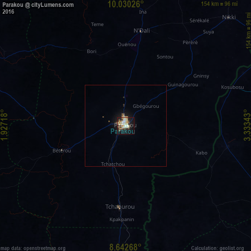
Analysis of Parakou night lights 2016
Square area 10x10 km:
 0.87%
0.87%90-99
12.34%80-89
11.69%70-79
4.76%60-69
3.68%50-59
4.33%40-49
5.84%30-39
3.68%20-29
5.19%10-19
34.85%0-9
12.77%Square area 50x50 km:
0.03%90-99
0.5%80-89
0.48%70-79
0.31%60-69
0.15%50-59
0.19%40-49
0.42%30-39
0.18%20-29
0.31%10-19
2.38%0-9
95.06%Clear (daylight) street map image can be seen on geolist.org.
Map coordinates:
10° 1' 48.9" North, 1° 55' 37.8" East
9° 20' 13.8" North, 2° 37' 49.1" East
8° 38' 33.6" North, 3° 20' 0.3" East
Some cities around Parakou sort by population:
• Nikki
92.4 km =57.4 mi,  43°
43°
• Okuta, NG
62.1 km =38.6 mi,  102°
102°
• Bembèrèkè
99.1 km =61.6 mi,  2°
2°
• Tchaourou
50.2 km =31.2 mi,  184°
184°
• Yashikera, NG
97 km =60.3 mi,  60°
60°
• Bétérou
43.6 km =27.1 mi,  249°
249°
• Suya, NG
62.3 km =38.7 mi,  76°
76°
• Gwasero, NG
96.8 km =60.1 mi, 80°
2392204 (p: 163,753)
Sources (retrieved 2019-11-25):
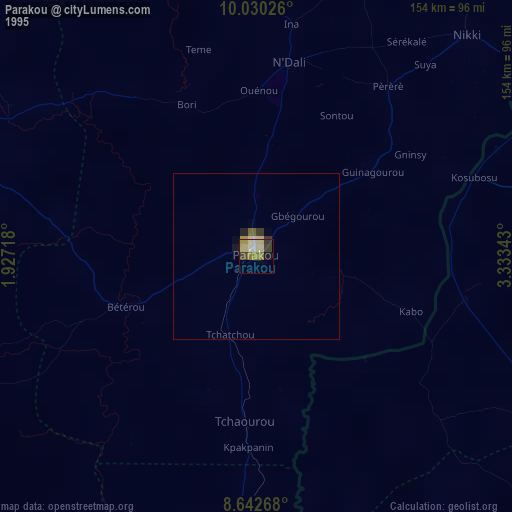
» NASA, Earths city lights 1995
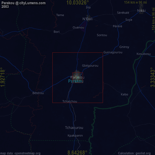
» NASA city lights 2003
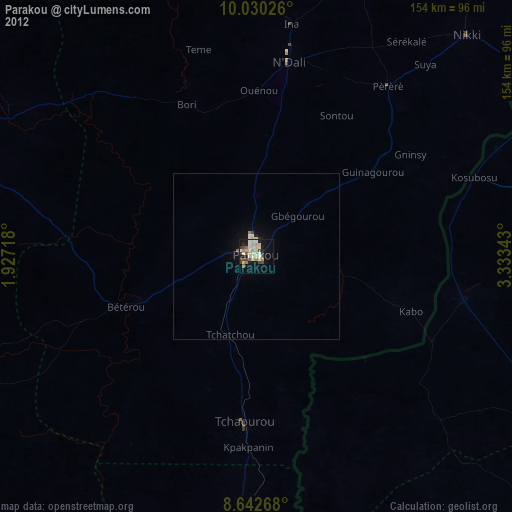
» Earth at Night: Flat Maps 2012, 2016