Abomey-Calavi night lights from space
Night Light of Abomey-Calavi (Atlantique) from space (Benin) Src. Average luminocity for 10x10km area is 42.7641% and for 50x50km: 10.5471%.
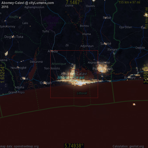
Analysis of Abomey-Calavi night lights 2016
Square area 10x10 km:
 0%
0%90-99
0.43%80-89
10.17%70-79
19.48%60-69
7.79%50-59
4.76%40-49
3.68%30-39
6.71%20-29
18.4%10-19
21.21%0-9
7.36%Square area 50x50 km:
0.35%90-99
0.9%80-89
1.84%70-79
3.27%60-69
1.13%50-59
0.96%40-49
1.57%30-39
1.95%20-29
3.83%10-19
7.86%0-9
76.34%Clear (daylight) street map image can be seen on geolist.org.
Map coordinates:
7° 8' 48.1" North, 1° 39' 9.1" East
6° 26' 54.7" North, 2° 21' 20.4" East
5° 44' 57.8" North, 3° 3' 31.6" East
Some cities around Abomey-Calavi sort by population:
• Cotonou
11.6 km =7.2 mi,  143°
143°
• Porto-Novo
27.9 km =17.3 mi,  78°
78°
• Ouidah
31.4 km =19.5 mi,  252°
252°
• Sakété
46.3 km =28.8 mi,  46°
46°
• Comé
52.5 km =32.6 mi,  265°
265°
• Allada
33 km =20.5 mi,  316°
316°
• Hévié
12.2 km =7.6 mi, 253°
• Idiroko, NG
47.8 km =29.7 mi,  64°
64°
2395914 (p: 385,755)
Sources (retrieved 2019-11-25):
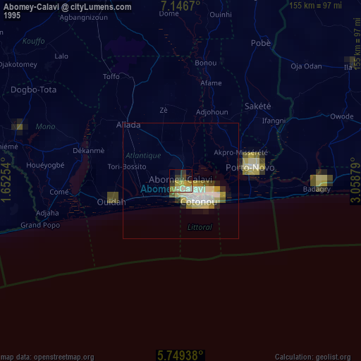
» NASA, Earths city lights 1995
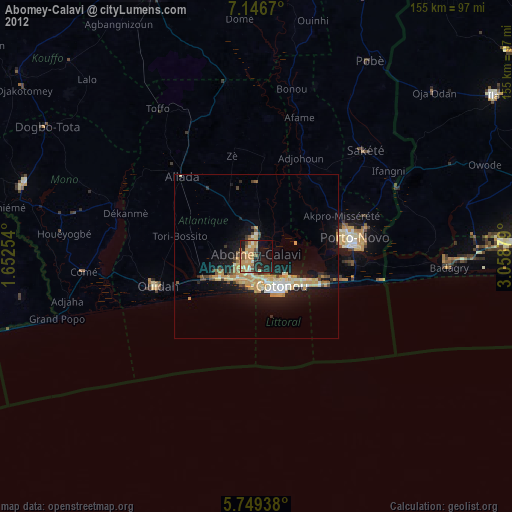
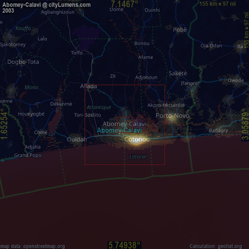
» NASA city lights 2003
» Earth at Night: Flat Maps 2012, 2016