Ouidah night lights from space
Night Light of Ouidah (Atlantique) from space (Benin) Src. Average luminocity for 10x10km area is 3.7944% and for 50x50km: 2.4915%.
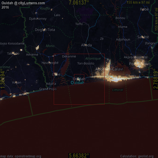
Analysis of Ouidah night lights 2016
Square area 10x10 km:
 0%
0%90-99
0%80-89
0%70-79
0%60-69
0.87%50-59
1.73%40-49
1.52%30-39
1.95%20-29
2.16%10-19
0.43%0-9
91.34%Square area 50x50 km:
0%90-99
0%80-89
0.19%70-79
0.38%60-69
0.44%50-59
0.55%40-49
0.88%30-39
0.97%20-29
1.01%10-19
1.83%0-9
93.74%Clear (daylight) street map image can be seen on geolist.org.
Map coordinates:
7° 3' 40.9" North, 1° 22' 55" East
6° 21' 47.1" North, 2° 5' 6.2" East
5° 39' 49.8" North, 2° 47' 17.5" East
Some cities around Ouidah sort by population:
• Cotonou
36.8 km =22.9 mi,  89°
89°
• Abomey-Calavi
31.4 km =19.5 mi,  72°
72°
• Lokossa
50.9 km =31.6 mi,  306°
306°
• Aného, TG
56.5 km =35.1 mi,  254°
254°
• Comé
23 km =14.3 mi,  282°
282°
• Allada
34.4 km =21.4 mi,  12°
12°
• Hévié
19.2 km =11.9 mi, 71°
• Grand-Popo
30.4 km =18.9 mi, 252°
2392308 (p: 83,503)
Sources (retrieved 2019-11-25):
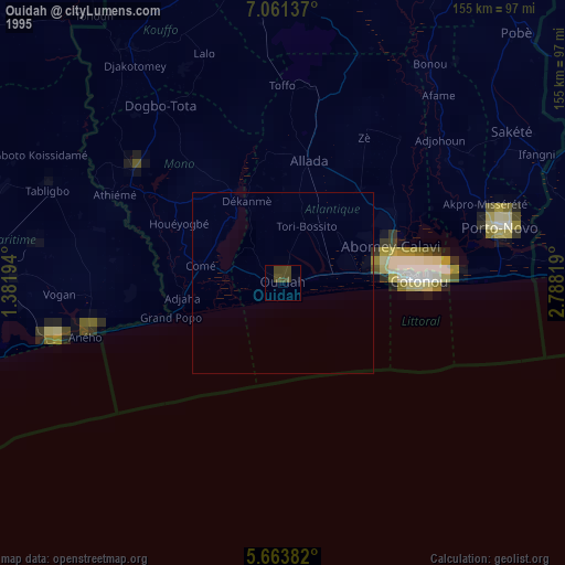
» NASA, Earths city lights 1995
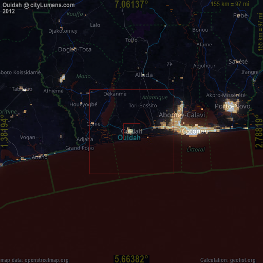
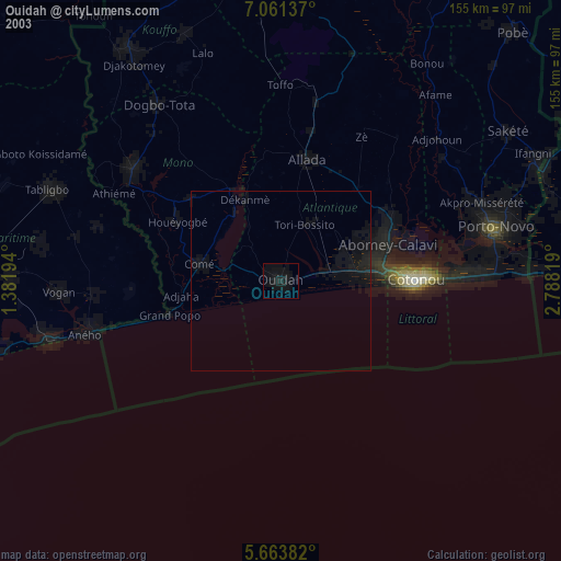
» NASA city lights 2003
» Earth at Night: Flat Maps 2012, 2016