Porto-Novo night lights from space
Night Light of Porto-Novo (Ouémé) from space (Benin) Src. Average luminocity for 10x10km area is 50.3658% and for 50x50km: 8.3021%.
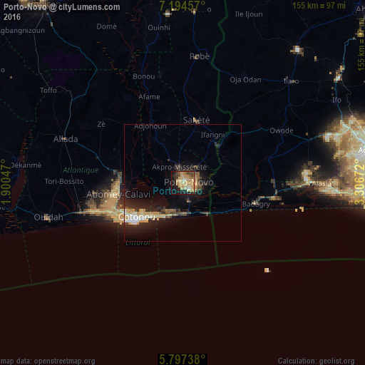
Analysis of Porto-Novo night lights 2016
Square area 10x10 km:
 1.52%
1.52%90-99
2.6%80-89
15.15%70-79
27.06%60-69
2.38%50-59
3.68%40-49
5.41%30-39
5.63%20-29
9.96%10-19
21.65%0-9
4.98%Square area 50x50 km:
0.39%90-99
0.93%80-89
1.49%70-79
2.42%60-69
0.47%50-59
0.62%40-49
1.05%30-39
1.22%20-29
3%10-19
6.99%0-9
81.41%Clear (daylight) street map image can be seen on geolist.org.
Map coordinates:
7° 11' 40.5" North, 1° 54' 1.7" East
6° 29' 47.3" North, 2° 36' 12.9" East
5° 47' 50.6" North, 3° 18' 24.2" East
Some cities around Porto-Novo sort by population:
• Cotonou
25.1 km =15.6 mi,  234°
234°
• Abomey-Calavi
27.9 km =17.3 mi,  258°
258°
• Sakété
27.3 km =17 mi,  12°
12°
• Badagry, NG
32 km =19.9 mi,  106°
106°
• Allada
53.4 km =33.2 mi,  290°
290°
• Ado-Odo, NG
38.9 km =24.2 mi,  73°
73°
• Hévié
40.1 km =24.9 mi, 257°
• Idiroko, NG
21.9 km =13.6 mi,  46°
46°
2392087 (p: 234,168)
Sources (retrieved 2019-11-25):
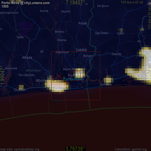
» NASA, Earths city lights 1995
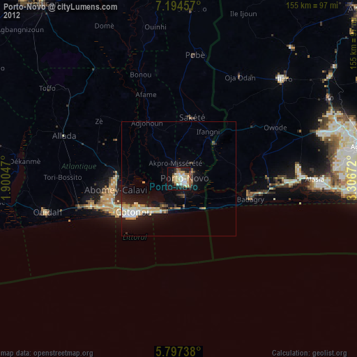
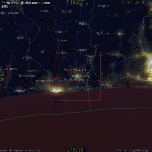
» NASA city lights 2003
» Earth at Night: Flat Maps 2012, 2016