Hévié night lights from space
Night Light of Hévié (Atlantique) from space (Benin) Src. Average luminocity for 10x10km area is 29.8593% and for 50x50km: 8.8131%.
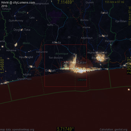
Analysis of Hévié night lights 2016
Square area 10x10 km:
 0%
0%90-99
0%80-89
2.16%70-79
6.71%60-69
4.55%50-59
7.79%40-49
11.69%30-39
11.69%20-29
13.2%10-19
16.02%0-9
26.19%Square area 50x50 km:
0.35%90-99
0.84%80-89
1.57%70-79
2.8%60-69
0.96%50-59
0.85%40-49
1.34%30-39
1.65%20-29
3.37%10-19
5.43%0-9
80.86%Clear (daylight) street map image can be seen on geolist.org.
Map coordinates:
7° 6' 53.6" North, 1° 32' 48.8" East
6° 25' 0" North, 2° 15' 0" East
5° 43' 3" North, 2° 57' 11.3" East
Some cities around Hévié sort by population:
• Cotonou
19.5 km =12.1 mi,  107°
107°
• Abomey-Calavi
12.2 km =7.6 mi,  73°
73°
• Porto-Novo
40.1 km =24.9 mi,  77°
77°
• Ouidah
19.2 km =11.9 mi,  251°
251°
• Sakété
57.4 km =35.7 mi,  51°
51°
• Comé
40.7 km =25.3 mi,  268°
268°
• Allada
29.7 km =18.5 mi,  338°
338°
• Grand-Popo
49.6 km =30.8 mi, 252°
2393887 (p: 13,450)
Sources (retrieved 2019-11-25):
» Earth at Night: Flat Maps 2012, 2016