Spa night lights from space
Night Light of Spa (Wallonia) from space (Belgium) Src. Average luminocity for 10x10km area is 8.2521% and for 50x50km: 13.2371%.
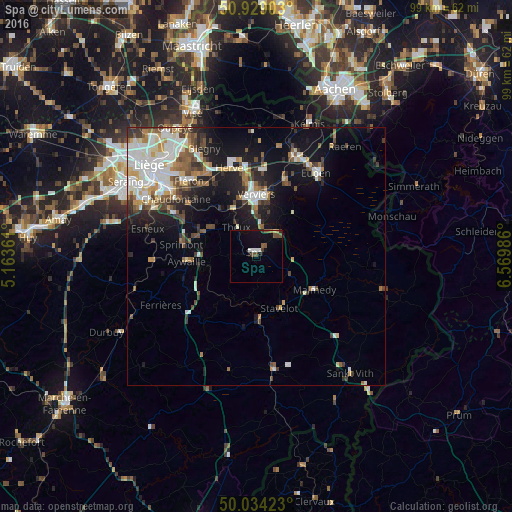
Analysis of Spa night lights 2016
Square area 10x10 km:
100  1.12%
1.12%
90-99 1.12%
80-89 0.28%
70-79 0.28%
60-69 0.28%
50-59 2.52%
40-49 2.38%
30-39 0.14%
20-29 0.56%
10-19 5.74%
0-9 85.57%
1.12%90-99
1.12%80-89
0.28%70-79
0.28%60-69
0.28%50-59
2.52%40-49
2.38%30-39
0.14%20-29
0.56%10-19
5.74%0-9
85.57%Square area 50x50 km:
100 2.57%
90-99 3.16%
80-89 1.15%
70-79 0.99%
60-69 1.48%
50-59 1.78%
40-49 1.83%
30-39 1.78%
20-29 2.48%
10-19 8.12%
0-9 74.66%
2.57%90-99
3.16%80-89
1.15%70-79
0.99%60-69
1.48%50-59
1.78%40-49
1.83%30-39
1.78%20-29
2.48%10-19
8.12%0-9
74.66%Clear (daylight) street map image can be seen on geolist.org.
Map coordinates:
50° 55' 44.5" North, 5° 9' 49" East
50° 29' 1.5" North, 5° 52' 0.3" East
50° 2' 3.2" North, 6° 34' 11.5" East
Some cities around Spa sort by population:
• Verviers
11.7 km =7.3 mi,  358°
358°
• Dison
14.1 km =8.8 mi, 356°
• Theux
6.7 km =4.2 mi,  325°
325°
• Malmédy
13 km =8.1 mi,  118°
118°
• Aywaille
13.5 km =8.4 mi,  265°
265°
• Pepinster
10.9 km =6.8 mi,  336°
336°
• Jalhay
11 km =6.8 mi,  40°
40°
• Stavelot
10.9 km =6.8 mi,  155°
155°
2786318 (p: 10,756)
Sources (retrieved 2019-11-25):
» Earth at Night: Flat Maps 2012, 2016