Stavelot night lights from space
Night Light of Stavelot (Wallonia) from space (Belgium) Src. Average luminocity for 10x10km area is 3.1232% and for 50x50km: 5.2223%.
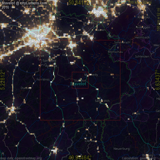
Analysis of Stavelot night lights 2016
Square area 10x10 km:
100  0%
0%
90-99 0.42%
80-89 0.42%
70-79 1.4%
60-69 0%
50-59 0.14%
40-49 0.98%
30-39 0%
20-29 0.7%
10-19 1.26%
0-9 94.68%
0%90-99
0.42%80-89
0.42%70-79
1.4%60-69
0%50-59
0.14%40-49
0.98%30-39
0%20-29
0.7%10-19
1.26%0-9
94.68%Square area 50x50 km:
100 0.67%
90-99 0.84%
80-89 0.36%
70-79 0.36%
60-69 0.58%
50-59 0.92%
40-49 1.12%
30-39 0.9%
20-29 1.44%
10-19 4.13%
0-9 88.68%
0.67%90-99
0.84%80-89
0.36%70-79
0.36%60-69
0.58%50-59
0.92%40-49
1.12%30-39
0.9%20-29
1.44%10-19
4.13%0-9
88.68%Clear (daylight) street map image can be seen on geolist.org.
Map coordinates:
50° 50' 28" North, 5° 13' 41.2" East
50° 23' 42" North, 5° 55' 52.5" East
49° 56' 40.7" North, 6° 38' 3.7" East
Some cities around Stavelot sort by population:
• Theux
17.5 km =10.9 mi,  331°
331°
• Malmédy
7.7 km =4.8 mi,  62°
62°
• Spa
10.9 km =6.8 mi,  335°
335°
• Saint-Vith
18.8 km =11.7 mi,  132°
132°
• Jalhay
18.4 km =11.4 mi,  8°
8°
• Vielsalm
12.4 km =7.7 mi,  185°
185°
• Waimes
13 km =8.1 mi,  80°
80°
• Amblève
17.5 km =10.9 mi,  105°
105°
2786185 (p: 6,646)
Sources (retrieved 2019-11-25):
» Earth at Night: Flat Maps 2012, 2016