Rixensart night lights from space
Night Light of Rixensart (Wallonia) from space (Belgium) Src. Average luminocity for 10x10km area is 46.1791% and for 50x50km: 40.9879%.
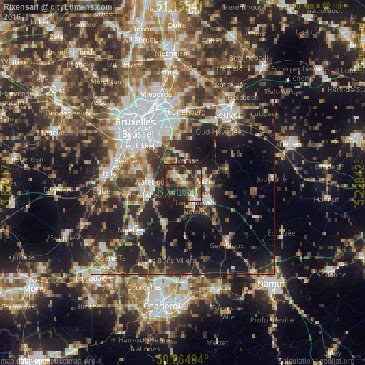
Analysis of Rixensart night lights 2016
Square area 10x10 km:
 4.28%
4.28%90-99
4.55%80-89
8.02%70-79
4.55%60-69
7.89%50-59
6.82%40-49
12.83%30-39
12.43%20-29
30.35%10-19
8.29%0-9
0%Square area 50x50 km:
9.71%90-99
7.19%80-89
3.2%70-79
4.17%60-69
5.4%50-59
5.65%40-49
6.67%30-39
8.09%20-29
11.82%10-19
17.94%0-9
20.17%Clear (daylight) street map image can be seen on geolist.org.
Map coordinates:
51° 9' 19.5" North, 3° 49' 19.8" East
50° 42' 44.2" North, 4° 31' 31" East
50° 15' 53.8" North, 5° 13' 42.3" East
Some cities around Rixensart sort by population:
• Wavre
5.4 km =3.4 mi,  84°
84°
• Waterloo
8.9 km =5.5 mi,  271°
271°
• Louvain-la-Neuve
8 km =5 mi,  127°
127°
• Overijse
6.9 km =4.3 mi,  5°
5°
• Basse Lasne
3 km =1.9 mi,  230°
230°
• Hoeilaart
7.3 km =4.5 mi,  326°
326°
• Ottignies
6 km =3.7 mi,  150°
150°
• La Hulpe
3.5 km =2.2 mi,  306°
306°
2787989 (p: 21,616)
Sources (retrieved 2019-11-25):
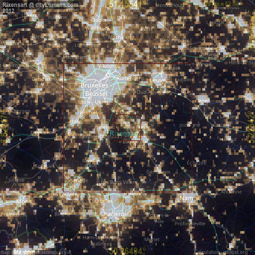
» Earth at Night: Flat Maps 2012, 2016