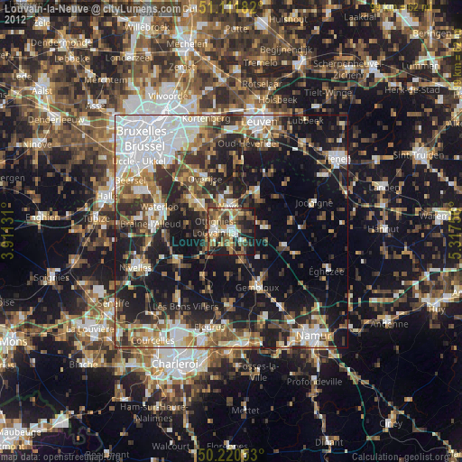
Louvain-la-Neuve night lights from space
Night Light of Louvain-la-Neuve (Wallonia) from space (Belgium) Src. Average luminocity for 10x10km area is 45.5829% and for 50x50km: 37.1026%.
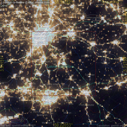
Analysis of Louvain-la-Neuve night lights 2016
Square area 10x10 km:
 7.09%
7.09%90-99
7.35%80-89
4.95%70-79
5.21%60-69
6.02%50-59
5.08%40-49
14.57%30-39
10.03%20-29
12.83%10-19
23.93%0-9
2.94%Square area 50x50 km:
8.65%90-99
6.32%80-89
3.09%70-79
4.01%60-69
4.92%50-59
4.76%40-49
5.38%30-39
6.64%20-29
10.88%10-19
18.78%0-9
26.56%Clear (daylight) street map image can be seen on geolist.org.
Map coordinates:
51° 6' 42.6" North, 3° 54' 40.7" East
50° 40' 5.8" North, 4° 36' 51.9" East
50° 13' 13.9" North, 5° 19' 3.2" East
Some cities around Louvain-la-Neuve sort by population:
• Wavre
5.5 km =3.4 mi,  350°
350°
• Rixensart
8 km =5 mi,  307°
307°
• Chaumont-Gistoux
7.6 km =4.7 mi,  82°
82°
• Ottignies
3.4 km =2.1 mi,  264°
264°
• Court-Saint-Étienne
5 km =3.1 mi,  220°
220°
• Mont-Saint-Guibert
3.8 km =2.4 mi,  184°
184°
• Chastre-Villeroux-Blanmont
6.9 km =4.3 mi,  163°
163°
• Walhain-Saint-Paul
7.5 km =4.7 mi,  128°
128°
2792073 (p: 29,521)
Sources (retrieved 2019-11-25):
» Earth at Night: Flat Maps 2012, 2016