Wavre night lights from space
Night Light of Wavre (Wallonia) from space (Belgium) Src. Average luminocity for 10x10km area is 46.6043% and for 50x50km: 37.6051%.
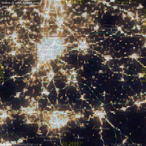
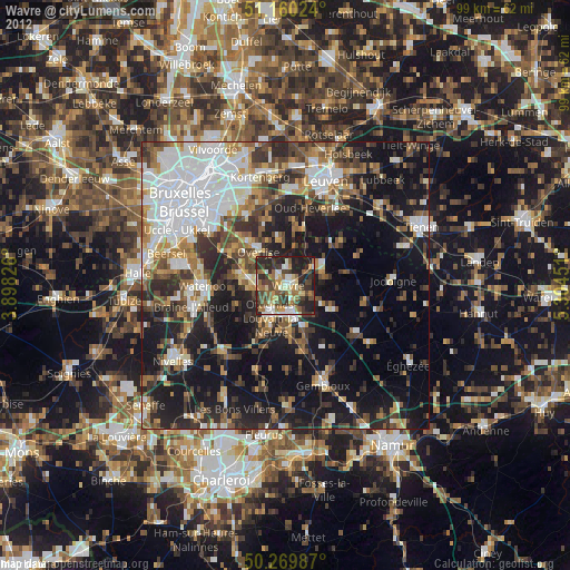
Analysis of Wavre night lights 2016
Square area 10x10 km:
 6.02%
6.02%90-99
7.09%80-89
6.15%70-79
6.02%60-69
6.55%50-59
6.42%40-49
11.9%30-39
11.1%20-29
18.18%10-19
19.39%0-9
1.2%Square area 50x50 km:
9.34%90-99
6.7%80-89
2.91%70-79
3.51%60-69
4.74%50-59
4.47%40-49
5.72%30-39
7.11%20-29
10.68%10-19
18.57%0-9
26.25%Clear (daylight) street map image can be seen on geolist.org.
Map coordinates:
51° 9' 36.9" North, 3° 53' 53.7" East
50° 43' 1.8" North, 4° 36' 5" East
50° 16' 11.5" North, 5° 18' 16.2" East
Some cities around Wavre sort by population:
• Louvain-la-Neuve
5.5 km =3.4 mi,  170°
170°
• Overijse
7.9 km =4.9 mi,  323°
323°
• Rixensart
5.4 km =3.4 mi,  264°
264°
• Basse Lasne
8.1 km =5 mi,  252°
252°
• Grez-Doiceau
7.2 km =4.5 mi,  70°
70°
• Ottignies
6.3 km =3.9 mi,  202°
202°
• Huldenberg
8.1 km =5 mi,  350°
350°
• La Hulpe
8.3 km =5.2 mi,  280°
280°
2783941 (p: 32,112)
Sources (retrieved 2019-11-25):
» Earth at Night: Flat Maps 2012, 2016