Profondeville night lights from space
Night Light of Profondeville (Wallonia) from space (Belgium) Src. Average luminocity for 10x10km area is 15.902% and for 50x50km: 13.5732%.
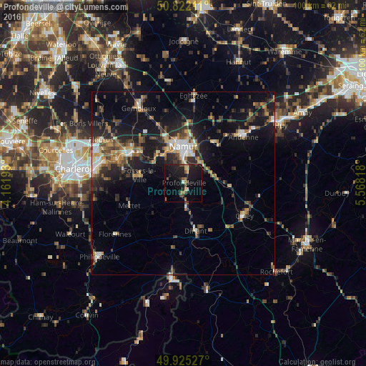
Analysis of Profondeville night lights 2016
Square area 10x10 km:
 0%
0%90-99
1.12%80-89
1.68%70-79
1.4%60-69
2.52%50-59
3.36%40-49
2.24%30-39
0.56%20-29
6.86%10-19
27.31%0-9
52.94%Square area 50x50 km:
1.15%90-99
1.92%80-89
1.2%70-79
1.61%60-69
1.81%50-59
2.05%40-49
2.81%30-39
2.25%20-29
4.58%10-19
10.73%0-9
69.87%Clear (daylight) street map image can be seen on geolist.org.
Map coordinates:
50° 49' 19.6" North, 4° 9' 42.9" East
50° 22' 32.9" North, 4° 51' 54.2" East
49° 55' 31" North, 5° 34' 5.4" East
Some cities around Profondeville sort by population:
• Namur
10.1 km =6.3 mi,  0°
0°
• Dinant
13.5 km =8.4 mi,  165°
165°
• Fosses-la-Ville
12.2 km =7.6 mi,  280°
280°
• Yvoir
5.4 km =3.4 mi, 168°
• Floreffe
9.9 km =6.2 mi,  311°
311°
• Anhée
7.3 km =4.5 mi, 172°
• Assesse
11.2 km =7 mi,  93°
93°
• Gesves
15.1 km =9.4 mi,  79°
79°
2788577 (p: 11,401)
Sources (retrieved 2019-11-25):
» Earth at Night: Flat Maps 2012, 2016