Dinant night lights from space
Night Light of Dinant (Wallonia) from space (Belgium) Src. Average luminocity for 10x10km area is 6.6524% and for 50x50km: 8.2728%.
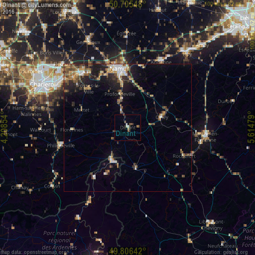
Analysis of Dinant night lights 2016
Square area 10x10 km:
 0.53%
0.53%90-99
1.07%80-89
0%70-79
0.53%60-69
0.67%50-59
2.27%40-49
1.07%30-39
1.6%20-29
1.34%10-19
0%0-9
90.91%Square area 50x50 km:
0.68%90-99
1.21%80-89
0.8%70-79
1.09%60-69
1.24%50-59
1.36%40-49
1.47%30-39
1.42%20-29
2.45%10-19
4.64%0-9
83.67%Clear (daylight) street map image can be seen on geolist.org.
Map coordinates:
50° 42' 19.7" North, 4° 12' 30.7" East
50° 15' 29.1" North, 4° 54' 42" East
49° 48' 23.1" North, 5° 36' 53.2" East
Some cities around Dinant sort by population:
• Ciney
14 km =8.7 mi,  73°
73°
• Profondeville
13.5 km =8.4 mi,  345°
345°
• Beauraing
16.7 km =10.4 mi,  169°
169°
• Yvoir
8.1 km =5 mi,  344°
344°
• Givet, FR
14.7 km =9.1 mi,  204°
204°
• Anhée
6.3 km =3.9 mi, 337°
• Assesse
14.6 km =9.1 mi,  32°
32°
• Hastière-Lavaux
7.6 km =4.7 mi,  234°
234°
2799357 (p: 12,875)
Sources (retrieved 2019-11-25):
» Earth at Night: Flat Maps 2012, 2016