Marchin night lights from space
Night Light of Marchin (Wallonia) from space (Belgium) Src. Average luminocity for 10x10km area is 7.0672% and for 50x50km: 15.3698%.
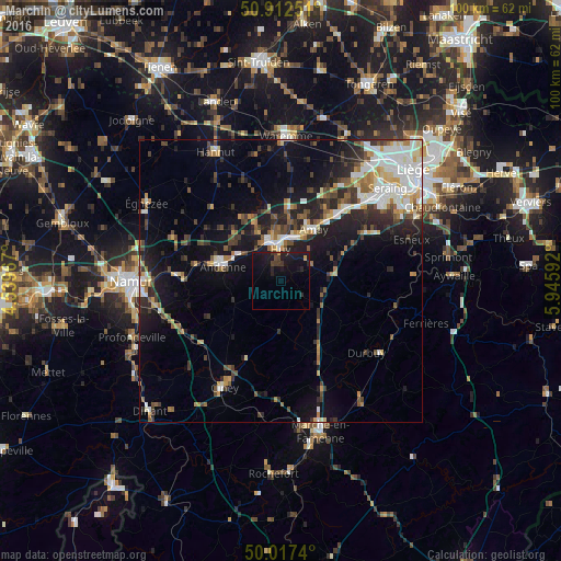
Analysis of Marchin night lights 2016
Square area 10x10 km:
100  0%
0%
90-99 0%
80-89 0%
70-79 0.84%
60-69 0%
50-59 0%
40-49 2.1%
30-39 1.82%
20-29 3.08%
10-19 19.33%
0-9 72.83%
0%90-99
0%80-89
0%70-79
0.84%60-69
0%50-59
0%40-49
2.1%30-39
1.82%20-29
3.08%10-19
19.33%0-9
72.83%Square area 50x50 km:
100 2.48%
90-99 2.92%
80-89 1.33%
70-79 1.57%
60-69 1.64%
50-59 1.76%
40-49 2.44%
30-39 2.53%
20-29 4.35%
10-19 9.75%
0-9 69.22%
2.48%90-99
2.92%80-89
1.33%70-79
1.57%60-69
1.64%50-59
1.76%40-49
2.44%30-39
2.53%20-29
4.35%10-19
9.75%0-9
69.22%Clear (daylight) street map image can be seen on geolist.org.
Map coordinates:
50° 54' 45" North, 4° 32' 22.8" East
50° 28' 1.5" North, 5° 14' 34.1" East
50° 1' 2.6" North, 5° 56' 45.3" East
Some cities around Marchin sort by population:
• Andenne
10.7 km =6.6 mi,  283°
283°
• Huy
5.8 km =3.6 mi,  353°
353°
• Amay
10.2 km =6.3 mi,  27°
27°
• Wanze
8.4 km =5.2 mi,  343°
343°
• Hamois
15.4 km =9.6 mi,  203°
203°
• Gesves
14 km =8.7 mi,  238°
238°
• Villers-le-Bouillet
12.3 km =7.6 mi,  5°
5°
• Nandrin
13.2 km =8.2 mi,  70°
70°
2791733 (p: 5,063)
Sources (retrieved 2019-11-25):
» Earth at Night: Flat Maps 2012, 2016