Huy night lights from space
Night Light of Huy (Wallonia) from space (Belgium) Src. Average luminocity for 10x10km area is 32.9706% and for 50x50km: 16.7556%.
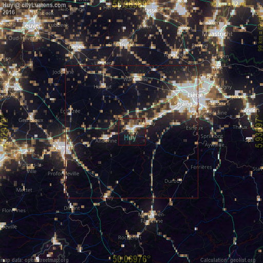
Analysis of Huy night lights 2016
Square area 10x10 km:
100  4.06%
4.06%
90-99 4.48%
80-89 2.66%
70-79 3.92%
60-69 4.34%
50-59 5.04%
40-49 7.98%
30-39 4.9%
20-29 12.46%
10-19 32.49%
0-9 17.65%
4.06%90-99
4.48%80-89
2.66%70-79
3.92%60-69
4.34%50-59
5.04%40-49
7.98%30-39
4.9%20-29
12.46%10-19
32.49%0-9
17.65%Square area 50x50 km:
100 2.48%
90-99 2.9%
80-89 1.45%
70-79 1.6%
60-69 1.82%
50-59 2.04%
40-49 2.79%
30-39 3.04%
20-29 5.32%
10-19 12.33%
0-9 64.25%
2.48%90-99
2.9%80-89
1.45%70-79
1.6%60-69
1.82%50-59
2.04%40-49
2.79%30-39
3.04%20-29
5.32%10-19
12.33%0-9
64.25%Clear (daylight) street map image can be seen on geolist.org.
Map coordinates:
50° 57' 50" North, 4° 31' 47" East
50° 31' 8.2" North, 5° 13' 58.2" East
50° 4' 11.1" North, 5° 56' 9.5" East
Some cities around Huy sort by population:
• Andenne
10.3 km =6.4 mi,  251°
251°
• Amay
6.3 km =3.9 mi,  59°
59°
• Wanze
2.8 km =1.7 mi,  322°
322°
• Villers-le-Bouillet
6.7 km =4.2 mi,  16°
16°
• Engis
13.7 km =8.5 mi, 59°
• Braives
13 km =8.1 mi,  327°
327°
• Nandrin
13.2 km =8.2 mi,  95°
95°
• Marchin
5.8 km =3.6 mi,  173°
173°
2795113 (p: 19,973)
Sources (retrieved 2019-11-25):
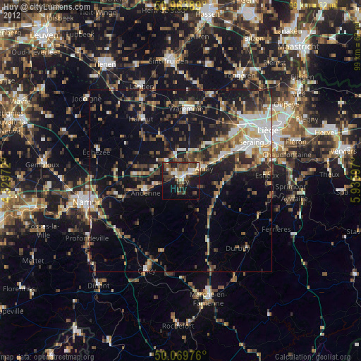
» Earth at Night: Flat Maps 2012, 2016