Nandrin night lights from space
Night Light of Nandrin (Wallonia) from space (Belgium) Src. Average luminocity for 10x10km area is 11.3431% and for 50x50km: 19.4155%.
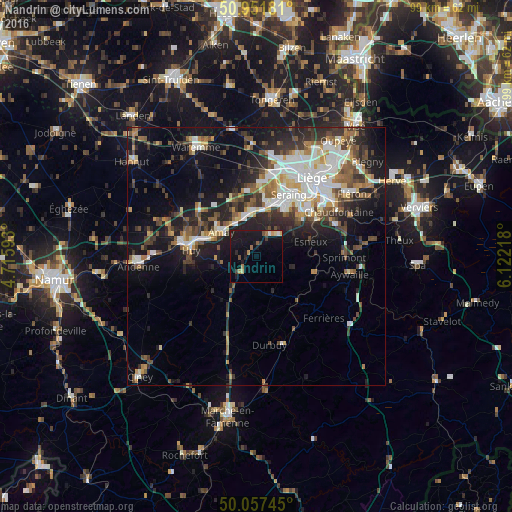
Analysis of Nandrin night lights 2016
Square area 10x10 km:
 0.42%
0.42%90-99
0.7%80-89
1.54%70-79
0.56%60-69
2.66%50-59
0.98%40-49
0.84%30-39
1.54%20-29
1.26%10-19
22.69%0-9
66.81%Square area 50x50 km:
3.36%90-99
3.88%80-89
1.6%70-79
1.79%60-69
2.2%50-59
2.83%40-49
3.05%30-39
3.43%20-29
5.67%10-19
11.52%0-9
60.67%Clear (daylight) street map image can be seen on geolist.org.
Map coordinates:
50° 57' 6.5" North, 4° 42' 57.3" East
50° 30' 24.3" North, 5° 25' 8.6" East
50° 3' 26.8" North, 6° 7' 19.8" East
Some cities around Nandrin sort by population:
• Seraing
10.3 km =6.4 mi,  34°
34°
• Flémalle-Haute
10.5 km =6.5 mi,  9°
9°
• Huy
13.2 km =8.2 mi,  275°
275°
• Esneux
11 km =6.8 mi,  72°
72°
• Amay
9 km =5.6 mi,  300°
300°
• Engis
8.4 km =5.2 mi,  350°
350°
• Comblain-au-Pont
11.7 km =7.3 mi,  107°
107°
• Marchin
13.2 km =8.2 mi,  250°
250°
2790467 (p: 5,480)
Sources (retrieved 2019-11-25):
» Earth at Night: Flat Maps 2012, 2016