Lier night lights from space
Night Light of Lier (Flanders) from space (Belgium) Src. Average luminocity for 10x10km area is 54.5615% and for 50x50km: 51.9302%.
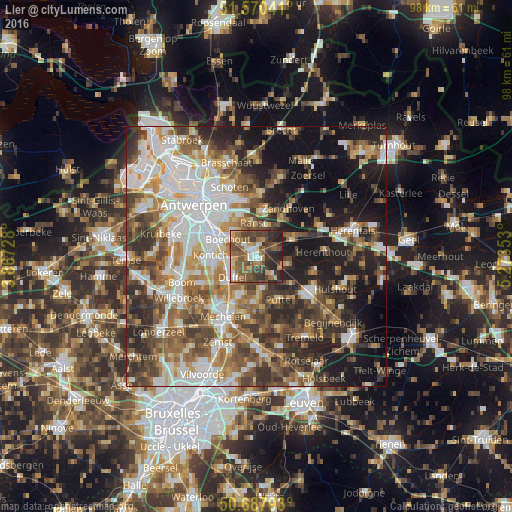
Analysis of Lier night lights 2016
Square area 10x10 km:
100  6.28%
6.28%
90-99 5.75%
80-89 5.08%
70-79 7.35%
60-69 10.03%
50-59 19.65%
40-49 18.72%
30-39 10.96%
20-29 14.84%
10-19 1.34%
0-9 0%
6.28%90-99
5.75%80-89
5.08%70-79
7.35%60-69
10.03%50-59
19.65%40-49
18.72%30-39
10.96%20-29
14.84%10-19
1.34%0-9
0%Square area 50x50 km:
100 10.76%
90-99 10.43%
80-89 4.75%
70-79 6.66%
60-69 7.67%
50-59 9%
40-49 9.36%
30-39 8.19%
20-29 11.18%
10-19 15.75%
0-9 6.25%
10.76%90-99
10.43%80-89
4.75%70-79
6.66%60-69
7.67%50-59
9%40-49
9.36%30-39
8.19%20-29
11.18%10-19
15.75%0-9
6.25%Clear (daylight) street map image can be seen on geolist.org.
Map coordinates:
51° 34' 13.5" North, 3° 52' 2.2" East
51° 7' 52.6" North, 4° 34' 13.5" East
50° 41' 16.5" North, 5° 16' 24.7" East
Some cities around Lier sort by population:
• Nijlen
7.7 km =4.8 mi,  64°
64°
• Sint-Katelijne-Waver
7.6 km =4.7 mi,  199°
199°
• Ranst
6.5 km =4 mi,  356°
356°
• Duffel
5.8 km =3.6 mi,  227°
227°
• Boechout
6.3 km =3.9 mi,  299°
299°
• Berlaar
6.3 km =3.9 mi,  103°
103°
• Lint
5.2 km =3.2 mi,  264°
264°
• Hove
7.4 km =4.6 mi,  290°
290°
2792397 (p: 33,272)
Sources (retrieved 2019-11-25):
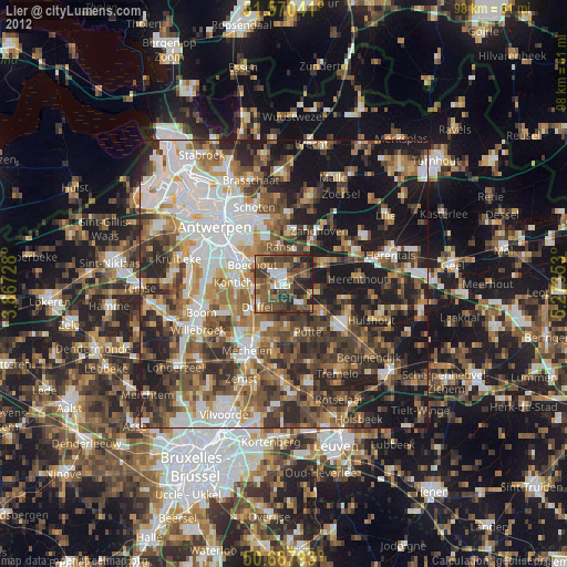
» Earth at Night: Flat Maps 2012, 2016