Ranst night lights from space
Night Light of Ranst (Flanders) from space (Belgium) Src. Average luminocity for 10x10km area is 59.4332% and for 50x50km: 47.9908%.
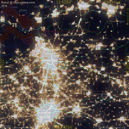
Analysis of Ranst night lights 2016
Square area 10x10 km:
100  8.16%
8.16%
90-99 9.09%
80-89 6.15%
70-79 12.3%
60-69 10.03%
50-59 13.77%
40-49 17.51%
30-39 8.96%
20-29 12.3%
10-19 1.74%
0-9 0%
8.16%90-99
9.09%80-89
6.15%70-79
12.3%60-69
10.03%50-59
13.77%40-49
17.51%30-39
8.96%20-29
12.3%10-19
1.74%0-9
0%Square area 50x50 km:
100 9.91%
90-99 9.39%
80-89 4.47%
70-79 5.91%
60-69 6.71%
50-59 8.06%
40-49 8.45%
30-39 7.34%
20-29 11.26%
10-19 18.53%
0-9 9.96%
9.91%90-99
9.39%80-89
4.47%70-79
5.91%60-69
6.71%50-59
8.06%40-49
8.45%30-39
7.34%20-29
11.26%10-19
18.53%0-9
9.96%Clear (daylight) street map image can be seen on geolist.org.
Map coordinates:
51° 37' 42.2" North, 3° 51' 43.9" East
51° 11' 23.4" North, 4° 33' 55.2" East
50° 44' 49.3" North, 5° 16' 6.4" East
Some cities around Ranst sort by population:
• Lier
6.5 km =4 mi,  176°
176°
• Schilde
5.8 km =3.6 mi,  12°
12°
• Zandhoven
7.3 km =4.5 mi,  67°
67°
• Boechout
6.1 km =3.8 mi,  236°
236°
• Wommelgem
3.4 km =2.1 mi,  298°
298°
• Borsbeek
5.6 km =3.5 mi,  277°
277°
• Wijnegem
5.3 km =3.3 mi,  322°
322°
• Hove
7.7 km =4.8 mi, 239°
2788348 (p: 17,405)
Sources (retrieved 2019-11-25):
» Earth at Night: Flat Maps 2012, 2016