Ittre night lights from space
Night Light of Ittre (Wallonia) from space (Belgium) Src. Average luminocity for 10x10km area is 39.4532% and for 50x50km: 42.9002%.
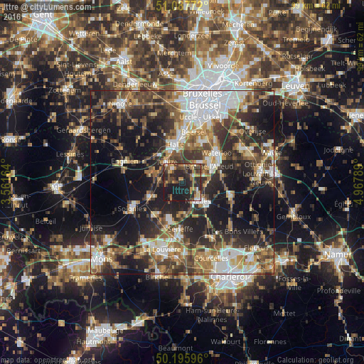
Analysis of Ittre night lights 2016
Square area 10x10 km:
 2.67%
2.67%90-99
2.41%80-89
4.95%70-79
8.29%60-69
5.48%50-59
8.56%40-49
6.95%30-39
9.36%20-29
22.86%10-19
28.48%0-9
0%Square area 50x50 km:
8.27%90-99
6.87%80-89
3.98%70-79
5.22%60-69
6.57%50-59
7.07%40-49
6.94%30-39
8.46%20-29
13.13%10-19
20.59%0-9
12.9%Clear (daylight) street map image can be seen on geolist.org.
Map coordinates:
51° 5' 15.8" North, 3° 33' 41.9" East
50° 38' 38.3" North, 4° 15' 53.1" East
50° 11' 45.5" North, 4° 58' 4.4" East
Some cities around Ittre sort by population:
• Braine-l'Alleud
8.5 km =5.3 mi,  58°
58°
• Halle
10.2 km =6.3 mi,  347°
347°
• Nivelles
6.8 km =4.2 mi,  138°
138°
• Tubize
6.9 km =4.3 mi,  319°
319°
• Braine-le-Comte
9.2 km =5.7 mi,  245°
245°
• Rebecq-Rognon
11.2 km =7 mi,  274°
274°
• Écaussinnes-d’Enghien
10.9 km =6.8 mi,  219°
219°
• Braine-le-Château
4 km =2.5 mi,  9°
9°
2795017 (p: 6,014)
Sources (retrieved 2019-11-25):
» Earth at Night: Flat Maps 2012, 2016