Braine-l'Alleud night lights from space
Night Light of Braine-l'Alleud (Wallonia) from space (Belgium) Src. Average luminocity for 10x10km area is 56.5762% and for 50x50km: 44.9895%.
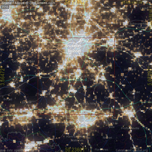
Analysis of Braine-l'Alleud night lights 2016
Square area 10x10 km:
 8.56%
8.56%90-99
12.83%80-89
4.81%70-79
9.63%60-69
8.42%50-59
9.76%40-49
5.75%30-39
16.31%20-29
20.72%10-19
3.21%0-9
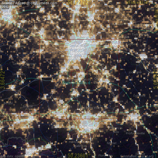
0%Square area 50x50 km:
9.87%90-99
7.69%80-89
3.88%70-79
5.09%60-69
6.35%50-59
7.1%40-49
7.21%30-39
8.12%20-29
12.6%10-19
21.29%0-9
10.81%Clear (daylight) street map image can be seen on geolist.org.
Map coordinates:
51° 7' 37.3" North, 3° 39' 53" East
50° 41' 1.1" North, 4° 22' 4.2" East
50° 14' 9.6" North, 5° 4' 15.5" East
Some cities around Braine-l'Alleud sort by population:
• Waterloo
4.1 km =2.5 mi,  32°
32°
• Nivelles
9.9 km =6.2 mi,  196°
196°
• Beersel
10.3 km =6.4 mi,  332°
332°
• Sint-Genesius-Rode
7 km =4.3 mi,  354°
354°
• Genappe
9.9 km =6.2 mi,  143°
143°
• Basse Lasne
8.8 km =5.5 mi,  81°
81°
• La Hulpe
9.8 km =6.1 mi,  57°
57°
• Ittre
8.5 km =5.3 mi,  238°
238°
2801154 (p: 37,512)
Sources (retrieved 2019-11-25):
» Earth at Night: Flat Maps 2012, 2016