Braine-le-Château night lights from space
Night Light of Braine-le-Château (Wallonia) from space (Belgium) Src. Average luminocity for 10x10km area is 48.3476% and for 50x50km: 44.0399%.
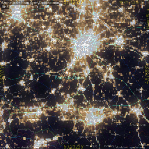
Analysis of Braine-le-Château night lights 2016
Square area 10x10 km:
 3.88%
3.88%90-99
4.28%80-89
4.28%70-79
7.75%60-69
7.35%50-59
13.37%40-49
12.57%30-39
24.87%20-29
17.51%10-19
4.14%0-9
0%Square area 50x50 km:
9.55%90-99
7.35%80-89
3.88%70-79
4.97%60-69
6.29%50-59
6.87%40-49
7.27%30-39
8.34%20-29
12.98%10-19
19.93%0-9
12.57%Clear (daylight) street map image can be seen on geolist.org.
Map coordinates:
51° 7' 24" North, 3° 34' 14.6" East
50° 40' 47.6" North, 4° 16' 25.9" East
50° 13' 56.1" North, 4° 58' 37.1" East
Some cities around Braine-le-Château sort by population:
• Halle
6.6 km =4.1 mi,  335°
335°
• Sint-Pieters-Leeuw
11.3 km =7 mi,  349°
349°
• Waterloo
9.6 km =6 mi,  66°
66°
• Nivelles
9.9 km =6.2 mi,  156°
156°
• Beersel
9.7 km =6 mi,  10°
10°
• Tubize
5.3 km =3.3 mi,  283°
283°
• Sint-Genesius-Rode
9.5 km =5.9 mi,  38°
38°
• Ittre
4 km =2.5 mi,  189°
189°
2801152 (p: 9,627)
Sources (retrieved 2019-11-25):
» Earth at Night: Flat Maps 2012, 2016