Herentals night lights from space
Night Light of Herentals (Flanders) from space (Belgium) Src. Average luminocity for 10x10km area is 39.8676% and for 50x50km: 31.8727%.
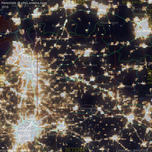
Analysis of Herentals night lights 2016
Square area 10x10 km:
 5.08%
5.08%90-99
6.55%80-89
4.41%70-79
2.27%60-69
8.16%50-59
7.75%40-49
4.68%30-39
4.28%20-29
20.05%10-19
35.43%0-9
1.34%Square area 50x50 km:
3.52%90-99
4.07%80-89
3%70-79
3.97%60-69
4.66%50-59
6.27%40-49
6.37%30-39
6%20-29
11.16%10-19
27.61%0-9
23.36%Clear (daylight) street map image can be seen on geolist.org.
Map coordinates:
51° 36' 54.9" North, 4° 7' 45.7" East
51° 10' 35.6" North, 4° 49' 56.9" East
50° 44' 1.1" North, 5° 32' 8.2" East
Some cities around Herentals sort by population:
• Geel
11 km =6.8 mi,  96°
96°
• Westerlo
11.2 km =7 mi,  148°
148°
• Nijlen
11.5 km =7.1 mi,  261°
261°
• Lille
7.3 km =4.5 mi,  354°
354°
• Olen
4.1 km =2.5 mi, 152°
• Grobbendonk
6.9 km =4.3 mi,  282°
282°
• Hulshout
11.7 km =7.3 mi,  194°
194°
• Vorselaar
5.1 km =3.2 mi,  304°
304°
2796009 (p: 25,912)
Sources (retrieved 2019-11-25):
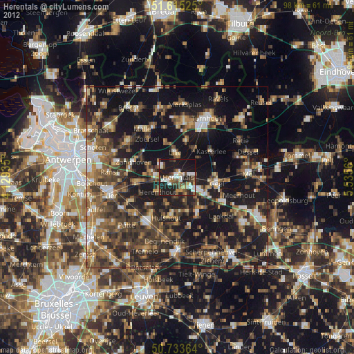
» Earth at Night: Flat Maps 2012, 2016