Dalhem night lights from space
Night Light of Dalhem (Wallonia) from space (Belgium) Src. Average luminocity for 10x10km area is 30.6457% and for 50x50km: 31.9346%.
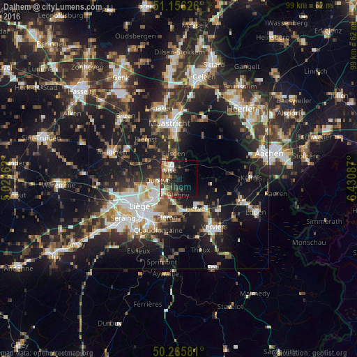
Analysis of Dalhem night lights 2016
Square area 10x10 km:
100  4.68%
4.68%
90-99 5.75%
80-89 0.67%
70-79 3.48%
60-69 5.75%
50-59 3.74%
40-49 7.35%
30-39 6.15%
20-29 9.63%
10-19 18.85%
0-9 33.96%
4.68%90-99
5.75%80-89
0.67%70-79
3.48%60-69
5.75%50-59
3.74%40-49
7.35%30-39
6.15%20-29
9.63%10-19
18.85%0-9
33.96%Square area 50x50 km:
100 5.28%
90-99 6.68%
80-89 2.64%
70-79 2.88%
60-69 3.92%
50-59 4.46%
40-49 4.48%
30-39 5.81%
20-29 11.23%
10-19 22.83%
0-9 29.8%
5.28%90-99
6.68%80-89
2.64%70-79
2.88%60-69
3.92%50-59
4.46%40-49
4.48%30-39
5.81%20-29
11.23%10-19
22.83%0-9
29.8%Clear (daylight) street map image can be seen on geolist.org.
Map coordinates:
51° 9' 22.5" North, 5° 1' 28.6" East
50° 42' 47.3" North, 5° 43' 39.9" East
50° 15' 56.9" North, 6° 25' 51.1" East
Some cities around Dalhem sort by population:
• Herstal
9.1 km =5.7 mi,  233°
233°
• Oupeye
5.7 km =3.5 mi,  268°
268°
• Visé
3.4 km =2.1 mi,  323°
323°
• Herve
9.3 km =5.8 mi,  150°
150°
• Blégny
4.5 km =2.8 mi,  182°
182°
• Eijsden, NL
7.5 km =4.7 mi,  354°
354°
• Beyne-Heusay
11 km =6.8 mi,  203°
203°
• Bassenge
9.7 km =6 mi,  301°
301°
2799897 (p: 6,391)
Sources (retrieved 2019-11-25):
» Earth at Night: Flat Maps 2012, 2016