Oupeye night lights from space
Night Light of Oupeye (Wallonia) from space (Belgium) Src. Average luminocity for 10x10km area is 58.6818% and for 50x50km: 30.938%.
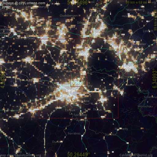
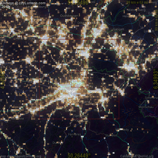
Analysis of Oupeye night lights 2016
Square area 10x10 km:
100  12.57%
90-99 15.37%
80-89 4.81%
70-79 6.95%
60-69 8.29%
50-59 6.55%
40-49 7.62%
30-39 11.23%
20-29 20.05%
10-19 6.55%
0-9 0%
12.57%90-99
15.37%80-89
4.81%70-79
6.95%60-69
8.29%50-59
6.55%40-49
7.62%30-39
11.23%20-29
20.05%10-19
6.55%0-9
0%Square area 50x50 km:
100 5.05%
90-99 6.24%
80-89 2.4%
70-79 2.67%
60-69 3.79%
50-59 4.26%
40-49 4.53%
30-39 5.45%
20-29 11.05%
10-19 23.82%
0-9 30.72%
5.05%90-99
6.24%80-89
2.4%70-79
2.67%60-69
3.79%50-59
4.26%40-49
4.53%30-39
5.45%20-29
11.05%10-19
23.82%0-9
30.72%Clear (daylight) street map image can be seen on geolist.org.
Map coordinates:
51° 9' 17.9" North, 4° 56' 37.2" East
50° 42' 42.6" North, 5° 38' 48.5" East
50° 15' 52.2" North, 6° 20' 59.7" East
Some cities around Oupeye sort by population:
• Herstal
5.6 km =3.5 mi,  197°
197°
• Visé
4.7 km =2.9 mi,  52°
52°
• Blégny
7 km =4.3 mi,  128°
128°
• Eijsden, NL
9.1 km =5.7 mi,  33°
33°
• Beyne-Heusay
10 km =6.2 mi,  172°
172°
• Juprelle
8.1 km =5 mi,  266°
266°
• Bassenge
5.8 km =3.6 mi,  333°
333°
• Dalhem
5.7 km =3.5 mi,  88°
88°
2789471 (p: 23,594)
Sources (retrieved 2019-11-25):
» Earth at Night: Flat Maps 2012, 2016