Péruwelz night lights from space
Night Light of Péruwelz (Wallonia) from space (Belgium) Src. Average luminocity for 10x10km area is 27.3964% and for 50x50km: 29.0134%.
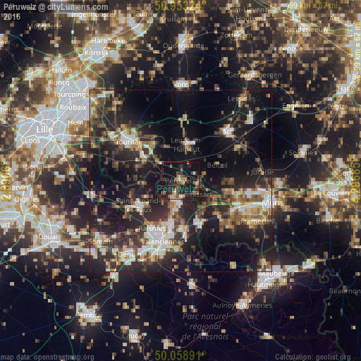
Analysis of Péruwelz night lights 2016
Square area 10x10 km:
 0.7%
0.7%90-99
2.66%80-89
1.96%70-79
2.66%60-69
3.92%50-59
6.58%40-49
5.6%30-39
6.86%20-29
11.48%10-19
41.88%0-9
15.69%Square area 50x50 km:
3.52%90-99
4.44%80-89
2.81%70-79
2.92%60-69
3.74%50-59
4.5%40-49
5.35%30-39
5.83%20-29
12.61%10-19
21.34%0-9
32.93%Clear (daylight) street map image can be seen on geolist.org.
Map coordinates:
50° 57' 11.7" North, 2° 53' 26.2" East
50° 30' 29.5" North, 3° 35' 37.4" East
50° 3' 32.1" North, 4° 17' 48.7" East
Some cities around Péruwelz sort by population:
• Beloeil
11 km =6.8 mi,  64°
64°
• Bruay-sur-l’Escaut, FR
12.6 km =7.8 mi,  196°
196°
• Bernissart
5.4 km =3.4 mi,  133°
133°
• Vieux-Condé, FR
5.7 km =3.5 mi, 198°
• Condé-sur-l’Escaut, FR
6 km =3.7 mi,  183°
183°
• Fresnes-sur-Escaut, FR
8.3 km =5.2 mi,  187°
187°
• Antoing
12.2 km =7.6 mi,  302°
302°
• Hensies
10.6 km =6.6 mi,  142°
142°
2789162 (p: 16,647)
Sources (retrieved 2019-11-25):
» Earth at Night: Flat Maps 2012, 2016