Sherpur night lights from space
Night Light of Sherpur (Mymensingh Division) from space (Bangladesh) Src. Average luminocity for 10x10km area is 21.8504% and for 50x50km: 2.7929%.
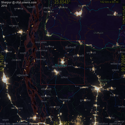

Analysis of Sherpur night lights 2016
Square area 10x10 km:
 1.33%
1.33%90-99
3.98%80-89
0.95%70-79
2.46%60-69
3.22%50-59
2.46%40-49
6.06%30-39
6.25%20-29
2.08%10-19
17.05%0-9
54.17%Square area 50x50 km:
0.1%90-99
0.32%80-89
0.15%70-79
0.25%60-69
0.29%50-59
0.63%40-49
0.77%30-39
0.9%20-29
0.74%10-19
1.33%0-9
94.53%Clear (daylight) street map image can be seen on geolist.org.
Map coordinates:
25° 39' 15.5" North, 89° 18' 51.8" East
25° 1' 7.7" North, 90° 1' 3" East
24° 22' 48.1" North, 90° 43' 14.3" East
Some cities around Sherpur sort by population:
• Mymensingh
48.9 km =30.4 mi,  126°
126°
• Bogra
67.8 km =42.1 mi,  254°
254°
• Jamālpur
13.1 km =8.1 mi,  212°
212°
• Sarishābāri
35.2 km =21.9 mi, 212°
• Tura, IN
58.1 km =36.1 mi,  18°
18°
• Chilmāri
69.2 km =43 mi,  329°
329°
• Mankāchar, IN
59.3 km =36.8 mi,  344°
344°
• Muktāgācha
37.2 km =23.1 mi,  139°
139°
1337248 (p: 107,419)
Sources (retrieved 2019-11-25):
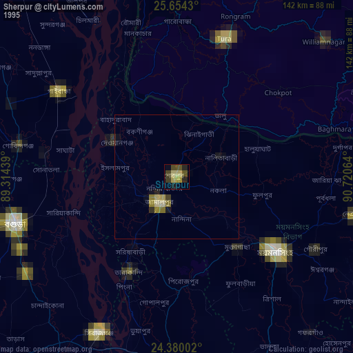
» NASA, Earths city lights 1995
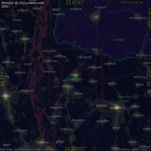
» NASA city lights 2003
» Earth at Night: Flat Maps 2012, 2016