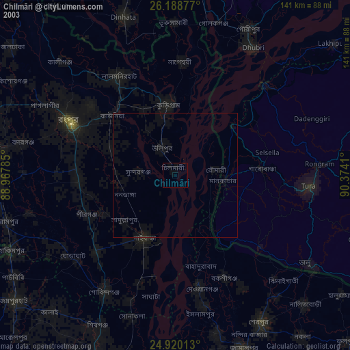
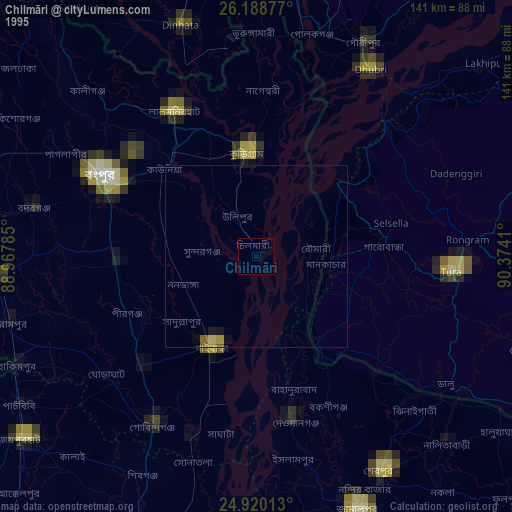
Chilmāri night lights from space
Night Light of Chilmāri (Rangpur Division) from space (Bangladesh) Src. Average luminocity for 10x10km area is 0.2424% and for 50x50km: 1.4202%.
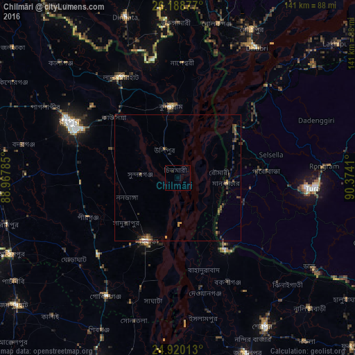
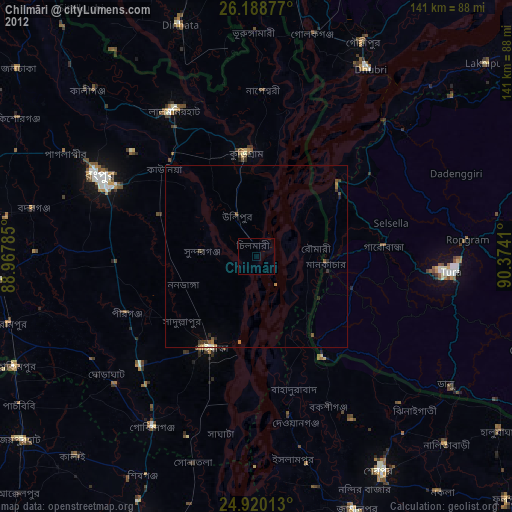
Analysis of Chilmāri night lights 2016
Square area 10x10 km:
 0%
0%90-99
0%80-89
0%70-79
0%60-69
0%50-59
0%40-49
0%30-39
0.76%20-29
0%10-19
0%0-9
99.24%Square area 50x50 km:
0.03%90-99
0.06%80-89
0.06%70-79
0.16%60-69
0.22%50-59
0.31%40-49
0.53%30-39
0.55%20-29
0.39%10-19
0.4%0-9
97.28%Clear (daylight) street map image can be seen on geolist.org.
Map coordinates:
26° 11' 19.6" North, 88° 58' 4.3" East
25° 33' 22.1" North, 89° 40' 15.5" East
24° 55' 12.5" North, 90° 22' 26.8" East
Some cities around Chilmāri sort by population:
• Rangpur
47.1 km =29.3 mi,  296°
296°
• Lalmonirhat
46 km =28.6 mi,  330°
330°
• Tura, IN
53.5 km =33.2 mi,  94°
94°
• Dhuburi, IN
60.3 km =37.5 mi,  31°
31°
• Nageswari
45.9 km =28.5 mi,  2°
2°
• Badarganj
63.3 km =39.3 mi,  281°
281°
• Mankāchar, IN
19.5 km =12.1 mi,  97°
97°
• Golakganj, IN
62.6 km =38.9 mi,  14°
14°
1185247 (p: 49,736)
Sources (retrieved 2019-11-25):
» NASA, Earths city lights 1995
» NASA city lights 2003
» Earth at Night: Flat Maps 2012, 2016