Gopālpur night lights from space
Night Light of Gopālpur (West Bengal) from space (India) Src. Average luminocity for 10x10km area is 16.1572% and for 50x50km: 30.0467%.
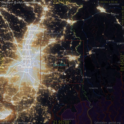
Analysis of Gopālpur night lights 2016
Square area 10x10 km:
 0%
0%90-99
0%80-89
0.19%70-79
0.76%60-69
0.57%50-59
2.08%40-49
3.98%30-39
7.01%20-29
10.23%10-19
33.71%0-9
41.48%Square area 50x50 km:
0.59%90-99
4.41%80-89
4.22%70-79
3.17%60-69
4.79%50-59
7.39%40-49
8.07%30-39
8.35%20-29
10%10-19
16.2%0-9
32.8%Clear (daylight) street map image can be seen on geolist.org.
Map coordinates:
23° 15' 57.4" North, 88° 2' 53.1" East
22° 37' 6.4" North, 88° 45' 4.3" East
21° 58' 4.4" North, 89° 27' 15.6" East
Some cities around Gopālpur sort by population:
• Bārāsat
29.9 km =18.6 mi,  292°
292°
• Hābra
26.7 km =16.6 mi,  338°
338°
• Ashoknagar Kalyangarh
29.7 km =18.5 mi, 336°
• Badūria
14.5 km =9 mi,  14°
14°
• Gobārdānga
28.8 km =17.9 mi,  0°
0°
• Tāki
18.9 km =11.7 mi,  100°
100°
• Gurdaha
13 km =8.1 mi, 3°
• Ula
23.2 km =14.4 mi,  299°
299°
1349263 (p: 6,890)
Sources (retrieved 2019-11-25):
» Earth at Night: Flat Maps 2012, 2016