Narsingdi night lights from space
Night Light of Narsingdi (Dhaka) from space (Bangladesh) Src. Average luminocity for 10x10km area is 46.5258% and for 50x50km: 18.9163%.
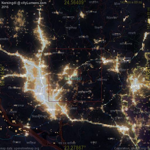
Analysis of Narsingdi night lights 2016
Square area 10x10 km:
 2.38%
2.38%90-99
8.93%80-89
7.94%70-79
4.37%60-69
3.97%50-59
13.1%40-49
14.09%30-39
13.49%20-29
11.71%10-19
16.07%0-9
3.97%Square area 50x50 km:
1.28%90-99
2.96%80-89
1.82%70-79
2.01%60-69
2.45%50-59
3.5%40-49
5.12%30-39
5.24%20-29
7.65%10-19
9.66%0-9
58.3%Clear (daylight) street map image can be seen on geolist.org.
Map coordinates:
24° 33' 50.7" North, 90° 0' 52.4" East
23° 55' 22.7" North, 90° 43' 3.6" East
23° 16' 43.2" North, 91° 25' 14.9" East
Some cities around Narsingdi sort by population:
• Dhaka
39.4 km =24.5 mi,  233°
233°
• Tungi
32.2 km =20 mi,  263°
263°
• Paltan
37.2 km =23.1 mi,  236°
236°
• Sonārgaon
32 km =19.9 mi,  198°
198°
• Bhairab Bāzār
30 km =18.6 mi,  61°
61°
• Azimpur
40 km =24.9 mi, 237°
• Bājitpur
40.2 km =25 mi,  35°
35°
• Nabīnagar
25.7 km =16 mi,  98°
98°
1185117 (p: 281,080)
Sources (retrieved 2019-11-25):
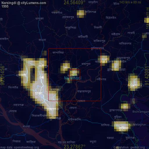
» NASA, Earths city lights 1995
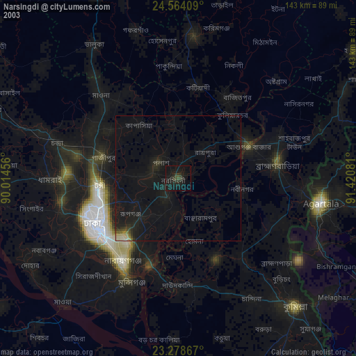
» NASA city lights 2003
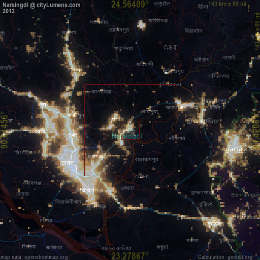
» Earth at Night: Flat Maps 2012, 2016