Sonārgaon night lights from space
Night Light of Sonārgaon (Dhaka) from space (Bangladesh) Src. Average luminocity for 10x10km area is 60.4762% and for 50x50km: 32.2793%.
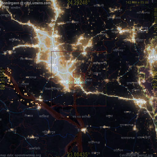
Analysis of Sonārgaon night lights 2016
Square area 10x10 km:
 7.14%
7.14%90-99
15.87%80-89
6.75%70-79
8.93%60-69
11.9%50-59
12.1%40-49
12.5%30-39
8.13%20-29
6.94%10-19
9.33%0-9
0.4%Square area 50x50 km:
7.33%90-99
8.69%80-89
3.06%70-79
3.06%60-69
3.67%50-59
3.68%40-49
4.3%30-39
4.5%20-29
7.34%10-19
8.89%0-9
45.49%Clear (daylight) street map image can be seen on geolist.org.
Map coordinates:
24° 17' 32.9" North, 89° 54' 48.8" East
23° 39' 0" North, 90° 37' 0" East
23° 0' 15.7" North, 91° 19' 11.3" East
Some cities around Sonārgaon sort by population:
• Dhaka
22.3 km =13.9 mi,  287°
287°
• Tungi
34.6 km =21.5 mi,  320°
320°
• Narsingdi
32 km =19.9 mi,  18°
18°
• Nārāyanganj
12.3 km =7.6 mi,  250°
250°
• Paltan
22.7 km =14.1 mi, 294°
• Azimpur
25.2 km =15.7 mi, 290°
• Joymontop
48.5 km =30.1 mi, 288°
• Nabīnagar
44.5 km =27.7 mi,  53°
53°
1187530 (p: 130,000)
Sources (retrieved 2019-11-25):
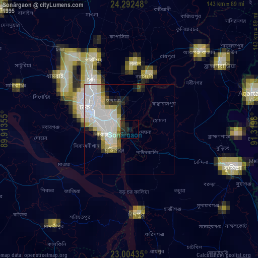
» NASA, Earths city lights 1995
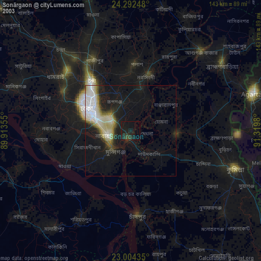
» NASA city lights 2003
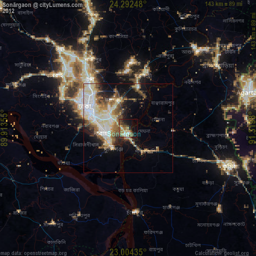
» Earth at Night: Flat Maps 2012, 2016