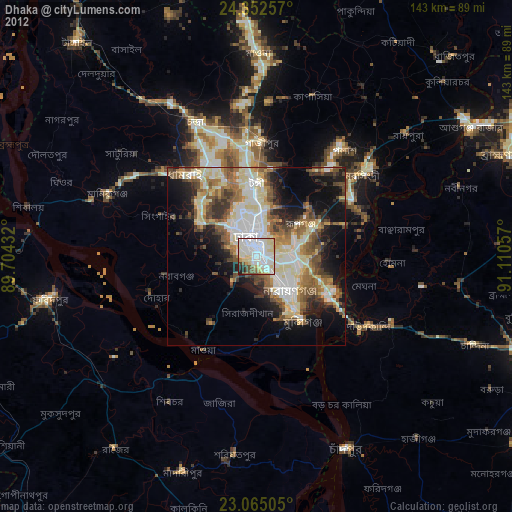
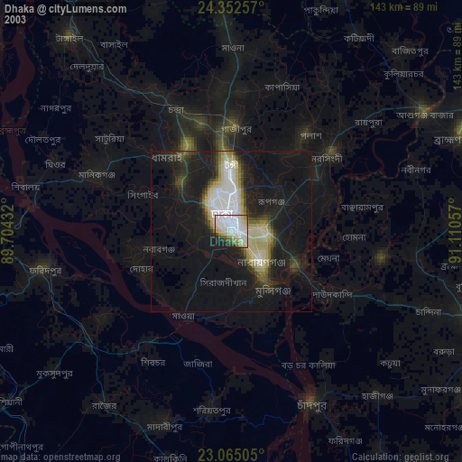
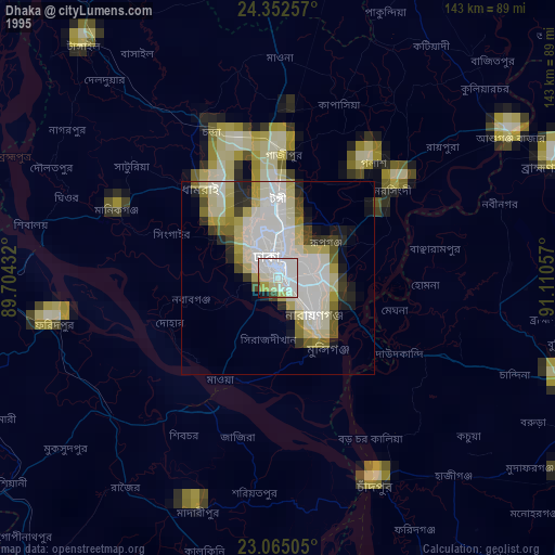
Dhaka night lights from space
Night Light of Dhaka from space (Bangladesh) Src. Average luminocity for 10x10km area is 90.5417% and for 50x50km: 45.0895%.
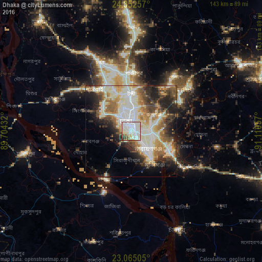
Analysis of Dhaka night lights 2016
Square area 10x10 km:
 46.43%
90-99
31.55%80-89
5.95%70-79
2.18%60-69
3.57%50-59
4.96%40-49
2.78%30-39
1.79%20-29
0.79%10-19
0%0-9
0%Square area 50x50 km:
9.55%90-99
13.63%80-89
4.63%70-79
4.82%60-69
5.72%50-59
5.78%40-49
5.91%30-39
5.16%20-29
8.31%10-19
8.31%0-9
28.2%Clear (daylight) street map image can be seen on geolist.org.
Map coordinates:
24° 21' 9.3" North, 89° 42' 15.6" East
23° 42' 37.4" North, 90° 24' 26.8" East
23° 3' 54.2" North, 91° 6' 38.1" East
Some cities around Dhaka sort by population:
• Tungi
20.1 km =12.5 mi,  358°
358°
• Nārāyanganj
14.5 km =9 mi,  137°
137°
• Paltan
3 km =1.9 mi,  13°
13°
• Sonārgaon
22.3 km =13.9 mi,  107°
107°
• Azimpur
3.1 km =1.9 mi,  313°
313°
• Joymontop
26.2 km =16.3 mi,  289°
289°
• Dohār
30 km =18.6 mi,  244°
244°
• Parvez Ali Hossain
26.1 km =16.2 mi, 289°
1185241 (p: 10,356,500)
Sources (retrieved 2019-11-25):
» NASA, Earths city lights 1995
» NASA city lights 2003
» Earth at Night: Flat Maps 2012, 2016