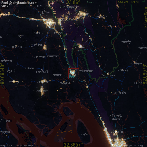
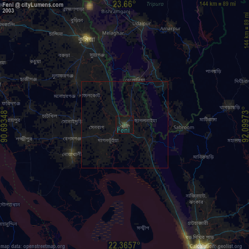
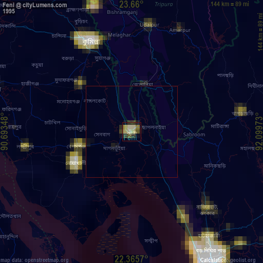
Feni night lights from space
Night Light of Feni (Chittagong) from space (Bangladesh) Src. Average luminocity for 10x10km area is 34.496% and for 50x50km: 6.0586%.
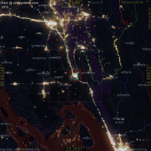
Analysis of Feni night lights 2016
Square area 10x10 km:
 4.76%
4.76%90-99
7.14%80-89
4.37%70-79
3.77%60-69
1.19%50-59
5.56%40-49
5.95%30-39
5.56%20-29
7.14%10-19
38.1%0-9
16.47%Square area 50x50 km:
0.28%90-99
0.5%80-89
0.27%70-79
0.3%60-69
0.36%50-59
1.04%40-49
2.4%30-39
1.68%20-29
2.11%10-19
4.45%0-9
86.6%Clear (daylight) street map image can be seen on geolist.org.
Map coordinates:
23° 39' 36" North, 90° 41' 36.5" East
23° 0' 51.8" North, 91° 23' 47.8" East
22° 21' 56.5" North, 92° 5' 59" East
Some cities around Feni sort by population:
• Comilla
54.2 km =33.7 mi,  336°
336°
• Bibir Hat
54.6 km =33.9 mi,  132°
132°
• Lākshām
37.7 km =23.4 mi,  311°
311°
• Chhāgalnāiya
11.8 km =7.3 mi,  84°
84°
• Manikchari
49.5 km =30.8 mi,  113°
113°
• Belonia, IN
27 km =16.8 mi,  12°
12°
• Sonāmura, IN
53 km =32.9 mi,  345°
345°
• Sabrūm, IN
33.6 km =20.9 mi,  92°
92°
1185224 (p: 84,028)
Sources (retrieved 2019-11-25):
» NASA, Earths city lights 1995
» NASA city lights 2003
» Earth at Night: Flat Maps 2012, 2016