Sonāmura night lights from space
Night Light of Sonāmura (Tripura) from space (India) Src. Average luminocity for 10x10km area is 54.7008% and for 50x50km: 21.8672%.
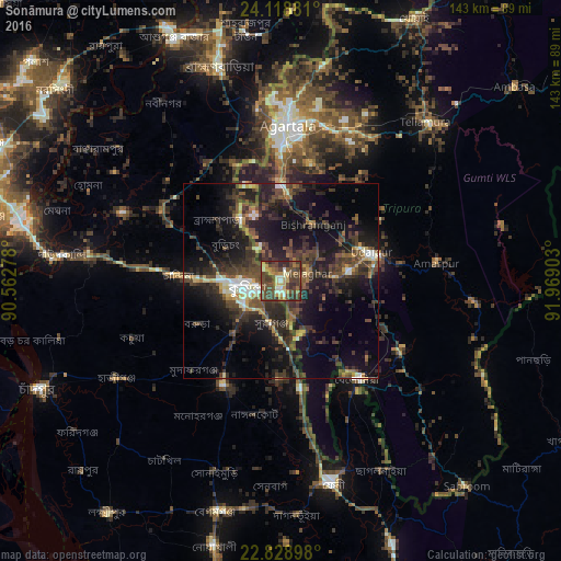
Analysis of Sonāmura night lights 2016
Square area 10x10 km:
 0.95%
0.95%90-99
10.98%80-89
5.49%70-79
9.47%60-69
6.25%50-59
8.9%40-49
35.23%30-39
15.91%20-29
6.82%10-19
0%0-9
0%Square area 50x50 km:
1.11%90-99
2.29%80-89
1.91%70-79
2.03%60-69
1.88%50-59
3.26%40-49
8.14%30-39
7.5%20-29
10.08%10-19
17.54%0-9
44.27%Clear (daylight) street map image can be seen on geolist.org.
Map coordinates:
24° 7' 7.7" North, 90° 33' 46" East
23° 28' 31.7" North, 91° 15' 57.2" East
22° 49' 44.3" North, 91° 58' 8.5" East
Some cities around Sonāmura sort by population:
• Comilla, BD
8.4 km =5.2 mi,  259°
259°
• Agartala
40.1 km =24.9 mi,  1°
1°
• Lākshām, BD
30 km =18.6 mi,  209°
209°
• Udaipur
23.1 km =14.4 mi,  73°
73°
• Barjala
18.3 km =11.4 mi,  30°
30°
• Belonia
31.4 km =19.5 mi,  142°
142°
• Amarpur
40.4 km =25.1 mi,  82°
82°
• Rānīr Bāzār
41.2 km =25.6 mi,  14°
14°
1255791 (p: 10,821)
Sources (retrieved 2019-11-25):
» Earth at Night: Flat Maps 2012, 2016