Char Bhadrāsan night lights from space
Night Light of Char Bhadrāsan (Dhaka) from space (Bangladesh) Src. Average luminocity for 10x10km area is 0.0758% and for 50x50km: 3.4452%.
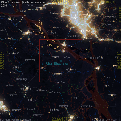
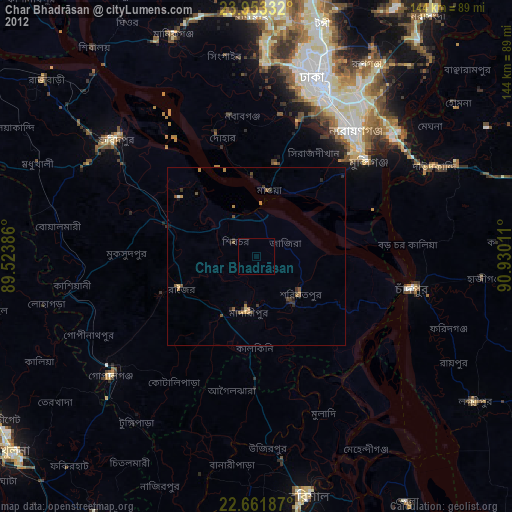
Analysis of Char Bhadrāsan night lights 2016
Square area 10x10 km:
 0%
0%90-99
0%80-89
0%70-79
0%60-69
0%50-59
0%40-49
0%30-39
0%20-29
0%10-19
0%0-9
100%Square area 50x50 km:
0.12%90-99
0.29%80-89
0.56%70-79
0.53%60-69
0.34%50-59
0.37%40-49
0.63%30-39
0.77%20-29
0.94%10-19
2.64%0-9
92.81%Clear (daylight) street map image can be seen on geolist.org.
Map coordinates:
23° 57' 12" North, 89° 31' 25.9" East
23° 18' 33" North, 90° 13' 37.1" East
22° 39' 42.7" North, 90° 55' 48.4" East
Some cities around Char Bhadrāsan sort by population:
• Dhaka
48.3 km =30 mi,  22°
22°
• Nārāyanganj
44 km =27.3 mi,  39°
39°
• Paltan
51.2 km =31.8 mi, 21°
• Azimpur
49.5 km =30.8 mi, 19°
• Mādārīpur
15.5 km =9.6 mi,  186°
186°
• Pālang
16.2 km =10.1 mi,  128°
128°
• Dohār
32.7 km =20.3 mi,  344°
344°
• Gaurnadi
37.3 km =23.2 mi,  180°
180°
1207047 (p: 34,423)
Sources (retrieved 2019-11-25):
» Earth at Night: Flat Maps 2012, 2016